MyTopo
Sycamore Oklahoma US Topo Map
Couldn't load pickup availability
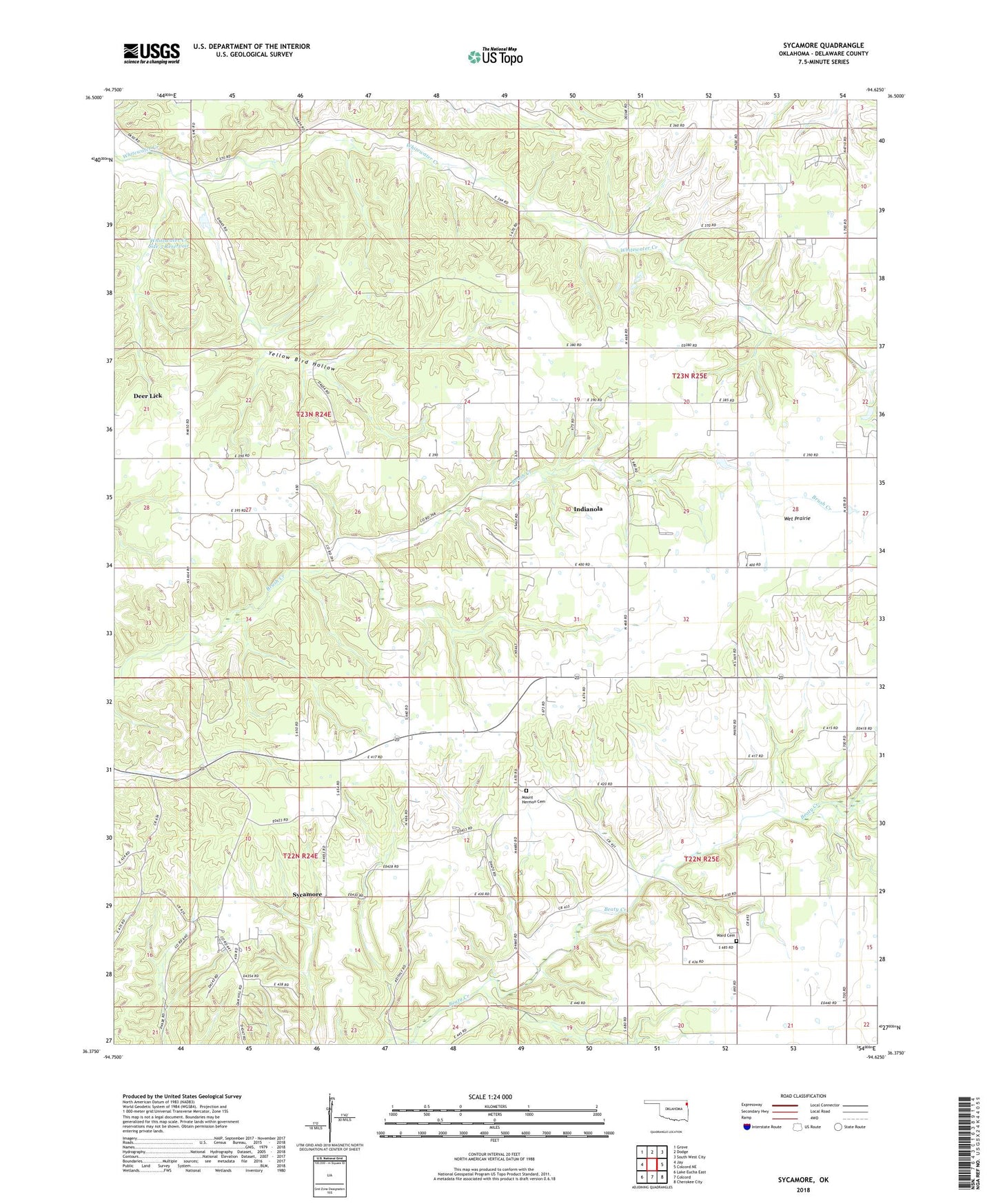
2022 topographic map quadrangle Sycamore in the state of Oklahoma. Scale: 1:24000. Based on the newly updated USGS 7.5' US Topo map series, this map is in the following counties: Delaware. The map contains contour data, water features, and other items you are used to seeing on USGS maps, but also has updated roads and other features. This is the next generation of topographic maps. Printed on high-quality waterproof paper with UV fade-resistant inks.
Quads adjacent to this one:
West: Jay
Northwest: Grove
North: Dodge
Northeast: South West City
East: Colcord NE
Southeast: Cherokee City
South: Colcord
Southwest: Lake Eucha East
This map covers the same area as the classic USGS quad with code o36094d6.
Contains the following named places: Deer Lick Census Designated Place, Immanuel Church, Indianola, Indianola Cemetery, Indianola Census Designated Place, Mount Herman Church, Mount Hermon Cemetery, Oak Chapel, Oak Hill-Piney, Oak Hill-Piney Census Designated Place, Poynor Church, Sycamore, Sycamore Census Designated Place, Sycamore Springs, Township 4, Ward Cemetery, Wet Prairie, Whitewater Church, Whitewater Creek Site 2 Dam, Whitewater Creek Site 2 Reservoir, Whitewater Creek Site 3 Dam, Whitewater Creek Site 3 Reservoir, Yellow Bird Hollow