MyTopo
Chidester Arkansas US Topo Map
Couldn't load pickup availability
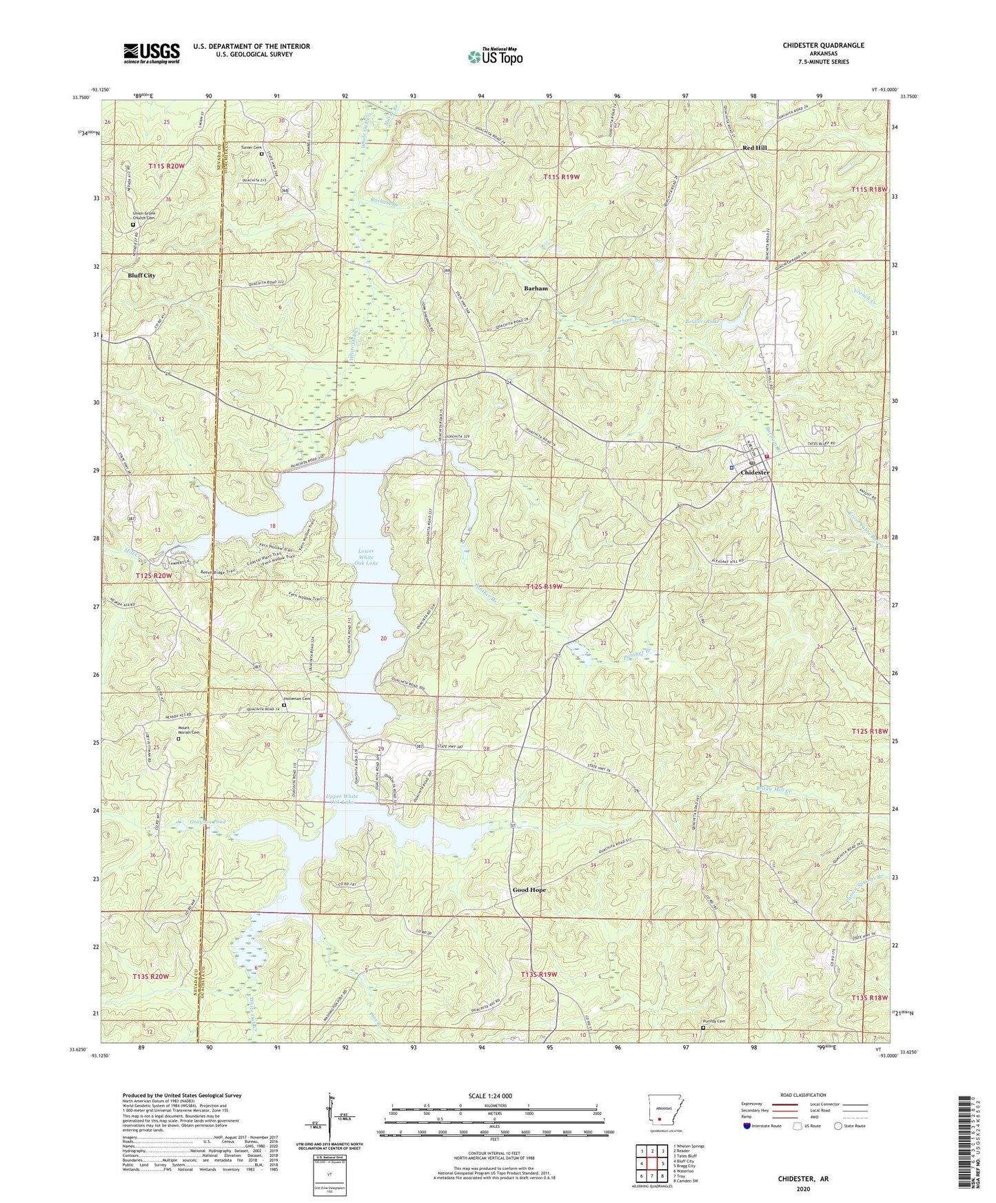
2024 topographic map quadrangle Chidester in the state of Arkansas. Scale: 1:24000. Based on the newly updated USGS 7.5' US Topo map series, this map is in the following counties: Ouachita, Nevada. The map contains contour data, water features, and other items you are used to seeing on USGS maps, but also has updated roads and other features. This is the next generation of topographic maps. Printed on high-quality waterproof paper with UV fade-resistant inks.
Quads adjacent to this one:
West: Bluff City
Northwest: Whelen Springs
North: Reader
Northeast: Tates Bluff
East: Bragg City
Southeast: Camden SW
South: Troy
Southwest: Waterloo
This map covers the same area as the classic USGS quad with code o33093f1.
Contains the following named places: Barham, Barham Branch, Beavers Lake, Beavers Lake Dam, Chidester, Chidester Elementary School, Chidester Police Department, Chidester Post Office, Chidester Volunteer Fire Department, City of Chidester, Good Hope, Grayson Pond, Harmony School, Holleman Cemetery, Lower White Oak Lake, Lower White Oak Lake Dam, Mill Creek, Mount Moriah Cemetery, Panther Branch, Pine Branch, Pleasant Hill Church, Poison Springs Lookout Tower, Poison Springs State Forest, Poison Springs State Park, Poison Springs Work Center, Purifoy Cemetery, Red Hill, Red Hill United Methodist Church, Township of Red Hill, Turner Cemetery, Union Grove Church, Union Grove Church Cemetery, Upper White Oak Lake, Upper White Oak Lake Dam, Upper White Oak Volunteer Fire Department Station, White Oak Lake, White Oak Lake State Park