MyTopo
Cominto Arkansas US Topo Map
Couldn't load pickup availability
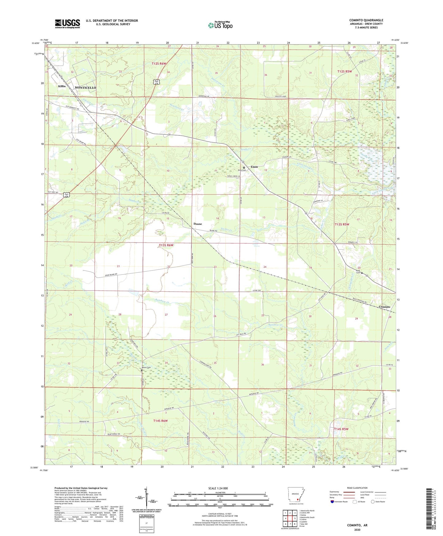
2024 topographic map quadrangle Cominto in the state of Arkansas. Scale: 1:24000. Based on the newly updated USGS 7.5' US Topo map series, this map is in the following counties: Drew. The map contains contour data, water features, and other items you are used to seeing on USGS maps, but also has updated roads and other features. This is the next generation of topographic maps. Printed on high-quality waterproof paper with UV fade-resistant inks.
Quads adjacent to this one:
West: Monticello South
Northwest: Monticello North
North: Collins NW
Northeast: Selma
East: Collins
Southeast: Line
South: Mist NW
Southwest: Ladelle
This map covers the same area as the classic USGS quad with code o33091e6.
Contains the following named places: Adcock Creek, Cominto, Cominto Baptist Church, Deane, Dickie Branch, Drew County, Enon, Enon Baptist Church, Enon Cemetery, Enon School, Hurricane Creek, Jade, Jeter, Killin, Little Wolf Creek, Moore Cemetery, Piney Creek, Puncheon Creek, Rainbow Creek, Rash Cemetery, Township of Cominto, Tucker Creek, Wolf Prairie