MyTopo
Concord Arkansas US Topo Map
Couldn't load pickup availability
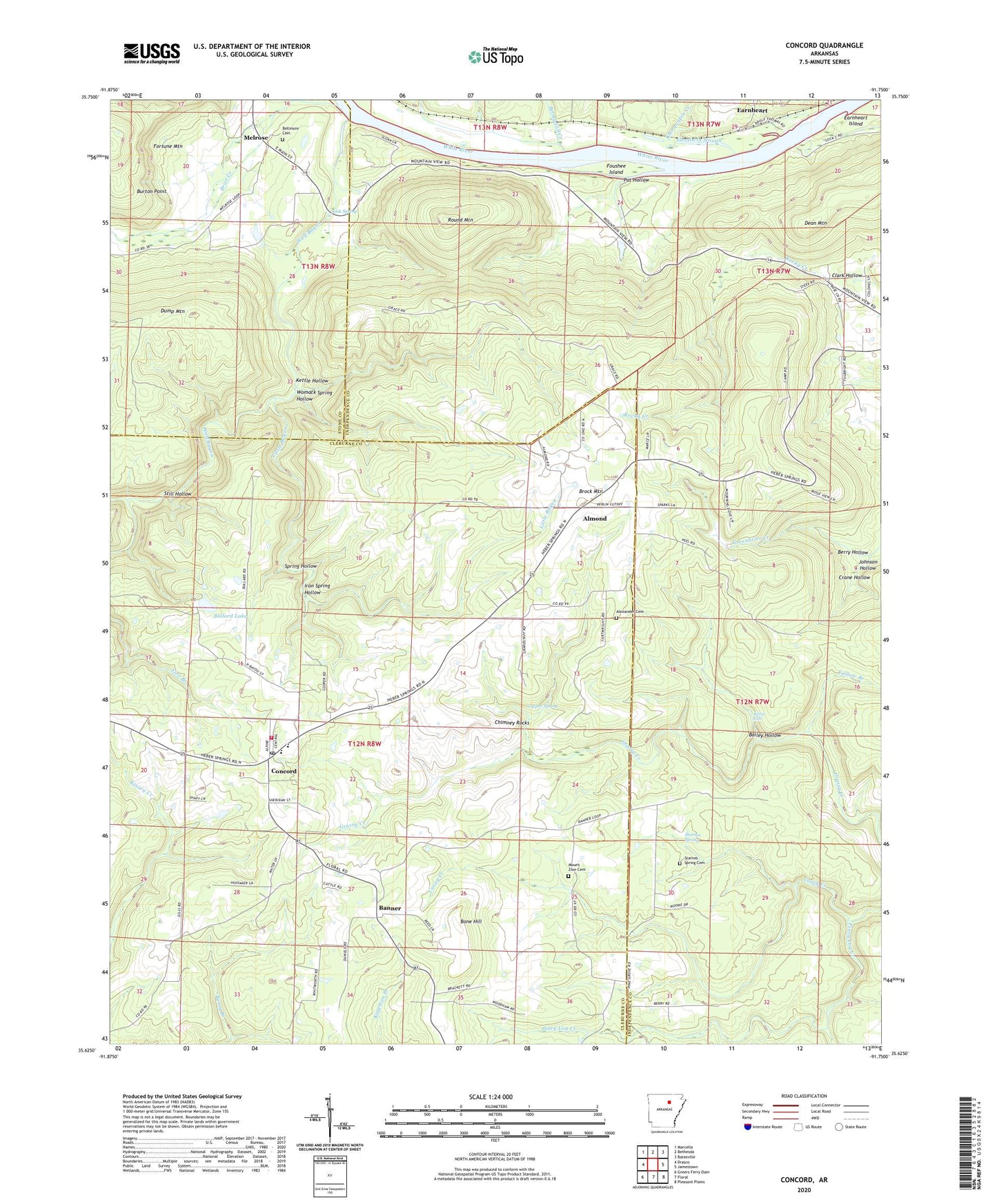
2024 topographic map quadrangle Concord in the state of Arkansas. Scale: 1:24000. Based on the newly updated USGS 7.5' US Topo map series, this map is in the following counties: Cleburne, Independence, Stone. The map contains contour data, water features, and other items you are used to seeing on USGS maps, but also has updated roads and other features. This is the next generation of topographic maps. Printed on high-quality waterproof paper with UV fade-resistant inks.
Quads adjacent to this one:
West: Drasco
Northwest: Marcella
North: Bethesda
Northeast: Batesville
East: Jamestown
Southeast: Pleasant Plains
South: Floral
Southwest: Greers Ferry Dam
This map covers the same area as the classic USGS quad with code o35091f7.
Contains the following named places: Alexander Cemetery, Almond, Almond Lookout Tower, Bailey Falls, Bailey Hollow, Banner, Banner Church, Bellmore Cemetery, Berry Hollow, Betsey Gill Creek, Bone Hill, Brier Creek, Brock Mountain, Bullard Lake, Bullard Lake Dam, Burton Point, Caney Creek, Chimney Rocks, Chinquapin Creek, Clark Hollow, Concord, Concord City Marshall's Office, Concord Elementary School, Concord High School, Concord Post Office, Concord Volunteer Fire Department, Copper Spring, Crane Hollow, Dean Mountain, Earnheart, Foushee Island, Foushee Slough, Goodwin Slough, Iron Spring Hollow, Johnson Hollow, Kettle Hollow, Little Bayou, Lock and Dam Number 2, Low Gap, Melrose, Melrose School, Mount Zion Baptist Church, Mount Zion Cemetery, Pat Hollow, Round Mountain, Sook Spring, Spring Hollow, Starnes Spring, Starnes Spring Cemetery, Starnes Springs Post Office, Still Hollow, Town of Concord, Township of Grassey, Wolf Bayou, Womack Spring Hollow, Yellow Branch, ZIP Codes: 72523, 72550