MyTopo
Yellville Arkansas US Topo Map
Couldn't load pickup availability
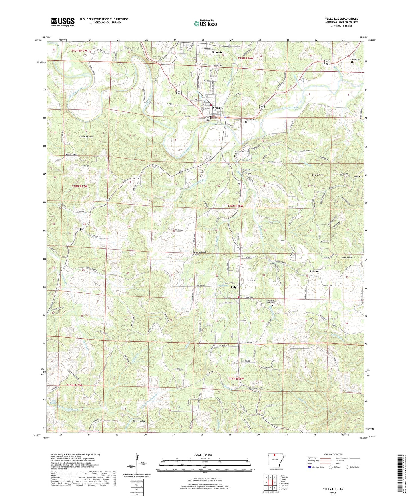
2024 topographic map quadrangle Yellville in the state of Arkansas. Scale: 1:24000. Based on the newly updated USGS 7.5' US Topo map series, this map is in the following counties: Marion. The map contains contour data, water features, and other items you are used to seeing on USGS maps, but also has updated roads and other features. This is the next generation of topographic maps. Printed on high-quality waterproof paper with UV fade-resistant inks.
Quads adjacent to this one:
West: Bruno
Northwest: Pyatt
North: Cotter SW
Northeast: Cotter
East: Rea Valley
Southeast: Cozahome
South: Maumee
Southwest: Saint Joe
This map covers the same area as the classic USGS quad with code o36092b6.
Contains the following named places: Bald Jesse, Big Springs, Brown Church, Burns Funeral Home Parking Lot Heliport, Campground Creek, City of Yellville, Cowan, Cowan Cemetery, Dean Branch, East Prong Town Branch, Freck Lookout Tower, Georges Creek, Glenn Spring, Goard Point, Gray Spring, Hogskin Creek, Hurricane Creek, KCTT-AM (Yellville), Marion County Courthouse, Marion County Hospital, Marion County Sheriff's Office, Mill Creek, Nanny Cemetery, Neilon Creek, New Hope Baptist Church, Pleasant Ridge Cemetery, Pleasant Ridge Methodist Church, Ralph, Ralph - Caney Rural Fire Protection District, Ralph Natural Bridge, Rocky Hollow School, Shakerag Creek, Standing Rock, Summit Baptist Church, Summit Post Office, Town Branch, Township of Big Springs, Township of Union, Township of Water Creek, Wickersham Cemetery, Wood Cemetery, Yellville, Yellville - Summit Elementary School, Yellville - Summit High School, Yellville - Summit Middle School, Yellville Cemetery, Yellville Post Office, Yellville Volunteer Fire Department, Yellville-summit Elementary School, ZIP Code: 72682