MyTopo
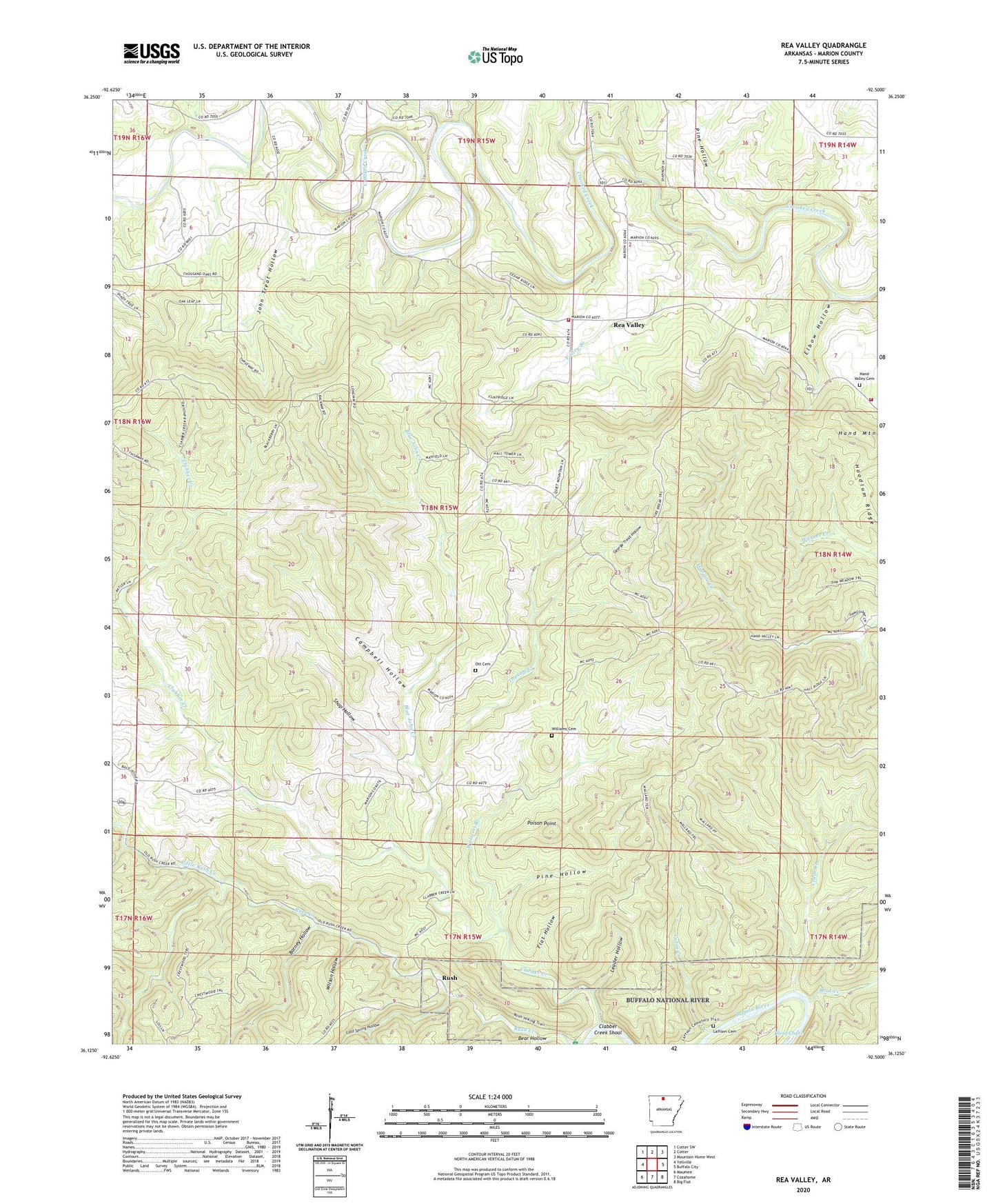
Rea Valley Arkansas US Topo Map
Couldn't load pickup availability
2024 topographic map quadrangle Rea Valley in the state of Arkansas. Scale: 1:24000. Based on the newly updated USGS 7.5' US Topo map series, this map is in the following counties: Marion. The map contains contour data, water features, and other items you are used to seeing on USGS maps, but also has updated roads and other features. This is the next generation of topographic maps. Printed on high-quality waterproof paper with UV fade-resistant inks.
Quads adjacent to this one:
West: Yellville
Northwest: Cotter SW
North: Cotter
Northeast: Mountain Home West
East: Buffalo City
Southeast: Big Flat
South: Cozahome
Southwest: Maumee
This map covers the same area as the classic USGS quad with code o36092b5.
Contains the following named places: Barney Hollow, Bear Hollow, Blind Chute, Blue John Creek, Boat Creek, Cabin Creek, Campbell Hollow, Cedar Creek, Clabber Creek, Clabber Creek Shoal, Cold Spring Hollow, Elbow Hollow, Flat Hollow, George Treat Hollow, Hall Mountain, Hamlet School, Hand Mountain, Hand Valley Cemetery, Hoodlum Ridge, Ingram Creek, John Treat Hollow, Laffoon Cemetery, Leader Hollow, Little Rush Creek, Ott Cemetery, Pine Hollow, Poison Point, Rea Valley, Rea Valley Baptist Church, Rea Valley School, Rea Valley Volunteer Fire Department, Rea Valley Volunteer Fire Department Station 2, Rush, Rush Historic District, Rush School, Shop Hollow, Township of Bearden, Township of Crooked Creek, Valley Branch, Wares Chapel, Williams Branch, Williams Cemetery, Wilson Hollow, ZIP Code: 72634