MyTopo
Mud Lake Arkansas US Topo Map
Couldn't load pickup availability
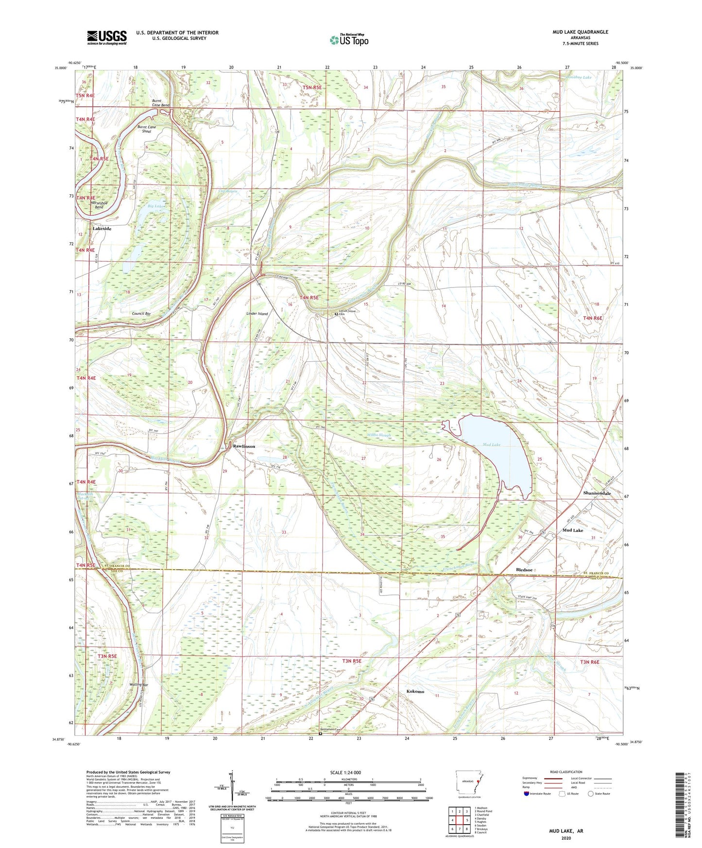
2024 topographic map quadrangle Mud Lake in the state of Arkansas. Scale: 1:24000. Based on the newly updated USGS 7.5' US Topo map series, this map is in the following counties: St. Francis, Lee. The map contains contour data, water features, and other items you are used to seeing on USGS maps, but also has updated roads and other features. This is the next generation of topographic maps. Printed on high-quality waterproof paper with UV fade-resistant inks.
Quads adjacent to this one:
West: Dansby
Northwest: Madison
North: Round Pond
Northeast: Chatfield
East: Hughes
Southeast: Council
South: Brickeys
Southwest: Soudan
This map covers the same area as the classic USGS quad with code o34090h5.
Contains the following named places: Bethlehem Cemetery, Big Lake, Big Rabbit Bayou, Bledsoe, Burnt Cane Bend, Burnt Cane Crossing, Burnt Cane Shoal, Corner Stone Church, Cornerstone Church, Council Bar, Cup Bayou, Cut-Off Ferry, Cut-off School, Donahue Lake, Ebling, Fifteenmile Bayou, Frenchman Bayou, Gospel Temple, Green Farm, Green School, Horseshoe Bend, Kingsley Crossing, Kokomo, Lakeside, Linder Island, Linders Mill, Locust Grove Cemetery, Locust Grove Church, Locust Grove School, Mound School, Mount Zion Church, Mud Lake, Pleasant Grove School, Pleasant Plain Church, Rawlinson, Robinson Ferry, Rollison Church, Rollison School, Section School, Shannondale, Shepperd Crossing, Township of Black Fish, Twin Bridge School, Walling Bar, Willbo Slough, Winona