MyTopo
Hughes Arkansas US Topo Map
Couldn't load pickup availability
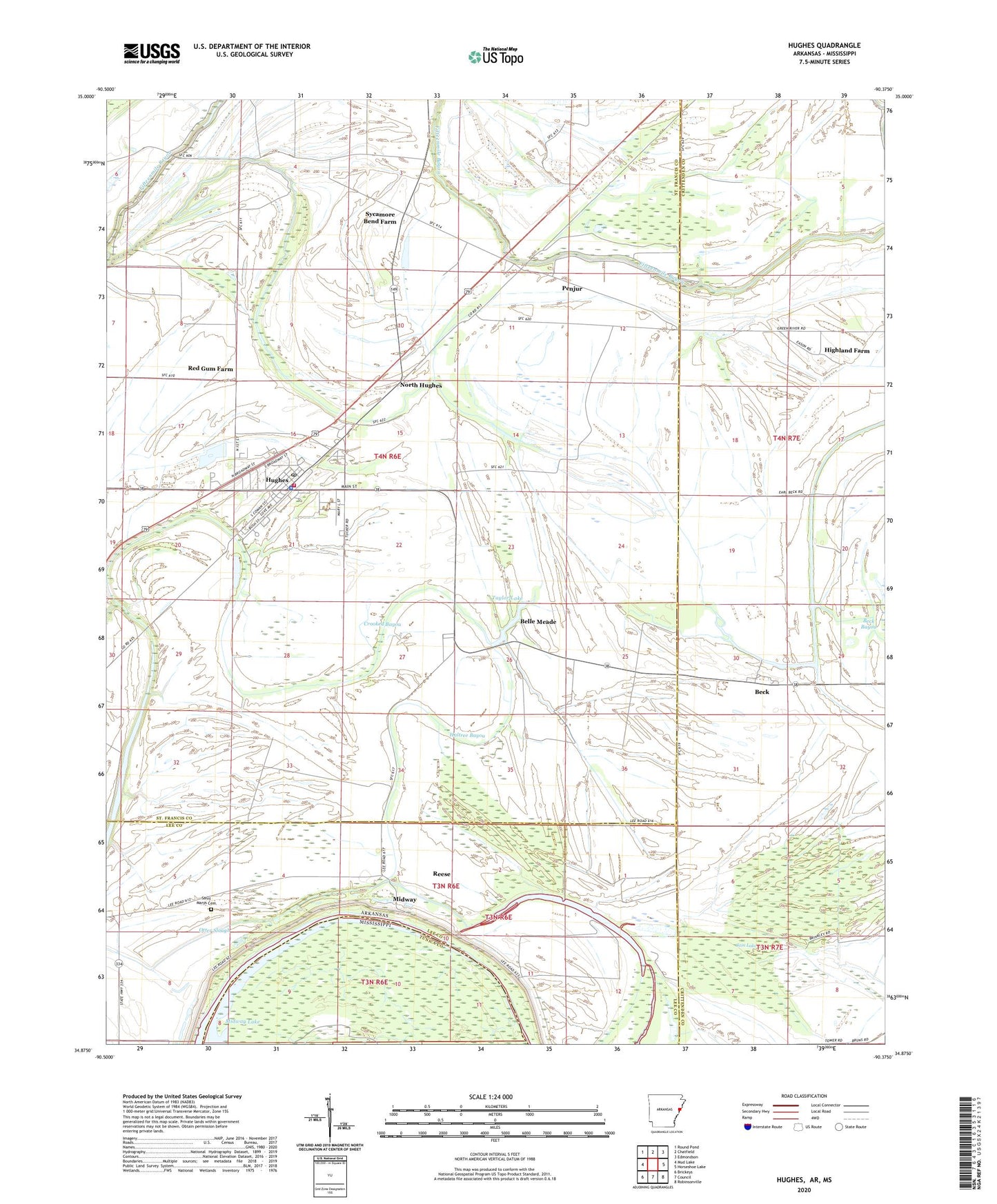
2024 topographic map quadrangle Hughes in the state of Arkansas. Scale: 1:24000. Based on the newly updated USGS 7.5' US Topo map series, this map is in the following counties: St. Francis, Crittenden, Lee, Tunica. The map contains contour data, water features, and other items you are used to seeing on USGS maps, but also has updated roads and other features. This is the next generation of topographic maps. Printed on high-quality waterproof paper with UV fade-resistant inks.
Quads adjacent to this one:
West: Mud Lake
Northwest: Round Pond
North: Chatfield
Northeast: Edmondson
East: Horseshoe Lake
Southeast: Robinsonville
South: Council
Southwest: Brickeys
Contains the following named places: Beck, Beck Bayou, Beck Church, Beck School, Belle Meade, Bright Future Farm, Cain Lake, City of Hughes, Crooked Bayou, Davis Biggs Farm, Deer Lake Farm, Goose Lake, Green River Church, Green River Plantation, Haltree Bayou, Highland Farm, Hughes, Hughes Elementary School, Hughes High School, Hughes Landing Strip, Hughes Police Department, Hughes Post Office, Hughes Volunteer Fire Department, Joe Beck Plantation, Midway, Mildred Jackson Elementary School, Millseed Lake, New Hope Farm, Nickey, North Hughes, Otter Slough, Penjur, Red Gum Church, Red Gum Farm, Reese, Saint Johns Church, Saint Lukes Church School, Saint Marys Cemetery, Saint Marys Missionary Church School, Saint Marys School, Sweet Home Church, Sycamore Bend Farm, Taylor Lake, Township of Garland, Tucker Field, Tucker Plantation, Windmill Church, ZIP Code: 72348