MyTopo
Deer Arkansas US Topo Map
Couldn't load pickup availability
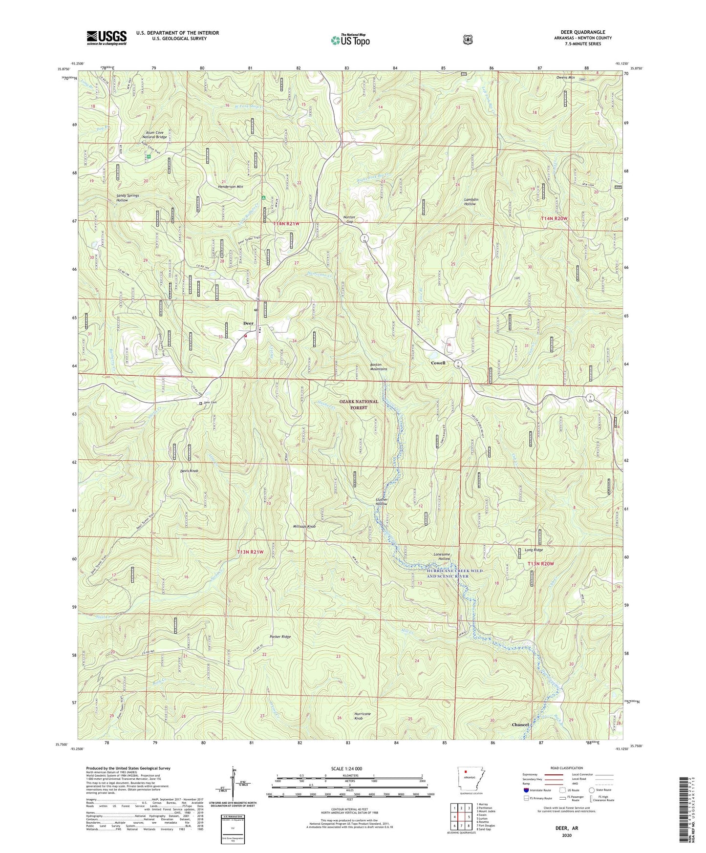
2024 topographic map quadrangle Deer in the state of Arkansas. Scale: 1:24000. Based on the newly updated USGS 7.5' US Topo map series, this map is in the following counties: Newton. The map contains contour data, water features, and other items you are used to seeing on USGS maps, but also has updated roads and other features. This is the next generation of topographic maps. Printed on high-quality waterproof paper with UV fade-resistant inks.
Quads adjacent to this one:
West: Swain
Northwest: Murray
North: Parthenon
Northeast: Mount Judea
East: Lurton
Southeast: Sand Gap
South: Fort Douglas
Southwest: Rosetta
This map covers the same area as the classic USGS quad with code o35093g2.
Contains the following named places: Alum Cove National Recreation Trail, Alum Cove Natural Bridge, Alum Cove Natural Bridge Recreation Area, Assembly of God Church, Buck Branch, Chancel, Cove Branch, Cowell, Cub Creek, Davis Knob, Deer, Deer Cemetery, Deer Census Designated Place, Deer Church, Deer Elementary School, Deer Fire Tower, Deer High School, Deer Post Office, Deer Rural Fire Department, Deer Work Center, Henderson Mountain, Hurricane Knob, Lambdin Hollow, Linn Creek, Little Buffalo Creek, Lonesome Hollow, Long Ridge, Mill Creek, Millsaps Knob, Mineral Spring School, Norton Gap, Owens Mountain, Parker Ridge, Pleasant Hill, Sandy Springs Hollow, Slusher Creek, Slusher Hollow, Stone Mountain Church, Township of Pleasant Hill, Township of Union, Wolf Creek