MyTopo
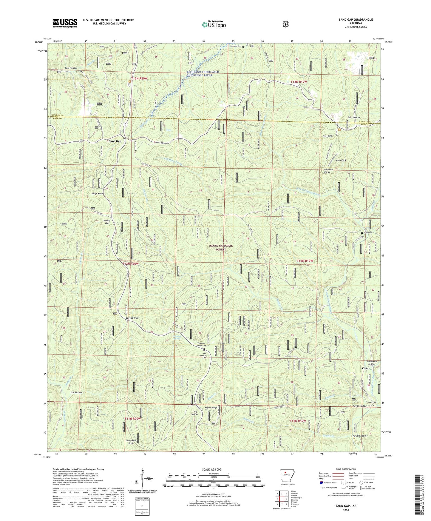
Sand Gap Arkansas US Topo Map
Couldn't load pickup availability
Also explore the Sand Gap Forest Service Topo of this same quad for updated USFS data
2024 topographic map quadrangle Sand Gap in the state of Arkansas. Scale: 1:24000. Based on the newly updated USGS 7.5' US Topo map series, this map is in the following counties: Pope, Newton. The map contains contour data, water features, and other items you are used to seeing on USGS maps, but also has updated roads and other features. This is the next generation of topographic maps. Printed on high-quality waterproof paper with UV fade-resistant inks.
Quads adjacent to this one:
West: Fort Douglas
Northwest: Deer
North: Lurton
Northeast: Moore
East: Smyrna
Southeast: Solo
South: Simpson
Southwest: Treat
This map covers the same area as the classic USGS quad with code o35093f1.
Contains the following named places: Arch Rock, Boss Hollow, Boyd Cemetery, Boyd School, Boyd Trail, Brock Cemetery, Burgiss Knob, Cedar Creek, Cherry Ridge Trail, Dare Mine Knob, Fairview Fire Tower, Fairview Recreation Area, Freeman Springs, Freeman Springs Cemetery, Gunter Branch, Gunter Trail, Hurricane Trail, Left Hand Prong, Mail Trail, Morning Shade School, Muddy Gap, New Freeman Cemetery, Nowlin Creek, Nowlin Hollow, Payne Creek, Payne Hollow, Payne Ridge, Pedestal Rocks, Pedestal Rocks Special Interest Area, Pedestal Rocks Trail, Pelsor Post Office, Richland Cemetery, Right Hand Prong, Rotary Ann Picnic Area, Sand Gap, Silver Point Trail, Sollys Knob, Still Hollow, Still Hollow Trail, Sulphur Creek, Sulphur Trail, Township of Freeman, Treadwell Hollow, Victor