MyTopo
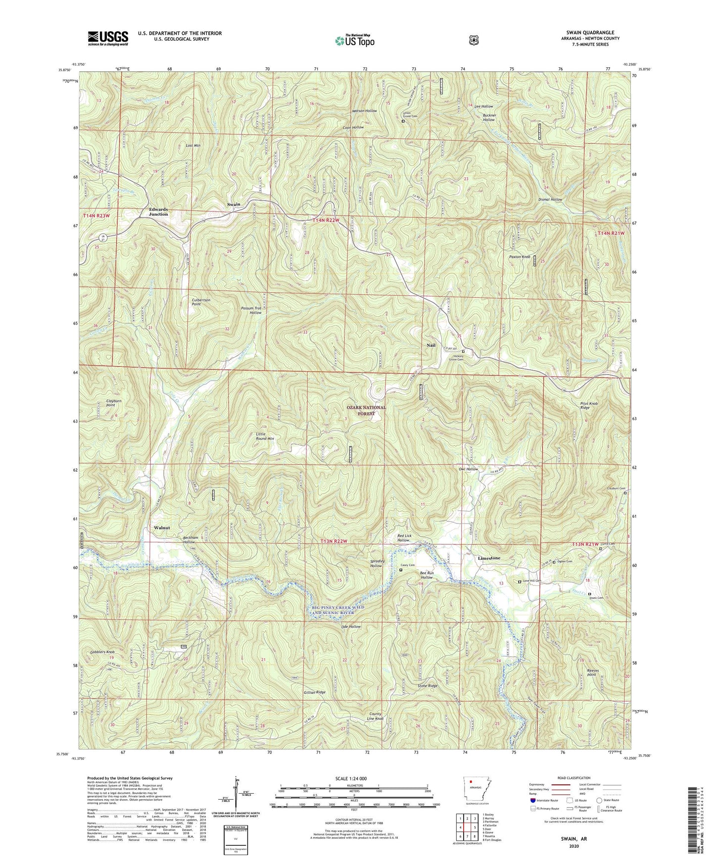
Swain Arkansas US Topo Map
Couldn't load pickup availability
Also explore the Swain Forest Service Topo of this same quad for updated USFS data
2024 topographic map quadrangle Swain in the state of Arkansas. Scale: 1:24000. Based on the newly updated USGS 7.5' US Topo map series, this map is in the following counties: Newton. The map contains contour data, water features, and other items you are used to seeing on USGS maps, but also has updated roads and other features. This is the next generation of topographic maps. Printed on high-quality waterproof paper with UV fade-resistant inks.
Quads adjacent to this one:
West: Fallsville
Northwest: Boxley
North: Murray
Northeast: Parthenon
East: Deer
Southeast: Fort Douglas
South: Rosetta
Southwest: Ozone
This map covers the same area as the classic USGS quad with code o35093g3.
Contains the following named places: Barberry Creek, Bear Creek, Beckham Hollow, Bee Run Hollow, Buckner Hollow, Casey Cemetery, Clayburn Cemetery, Clayburn Point, Cole Creek, Cooley Creek, Coon Hollow, County Line Knob, Culbertson Point, Curtis Cemetery, Curtis Creek, Dismal Creek, Dismal Hollow, Dog Branch, East Branch, East Cole Creek, Edwards Junction, Essex Cemetery, Flat Rock Creek, Gillian Ridge, Gladon Creek, Gobblers Knob, Hickory Grove Cemetery, Home Creek, Lee Hollow, Limestone, Little Round Mountain, Lone Hill Cemetery, Lost Mountain, Nail, Nail Post Office, Ode Hollow, Ogden Cemetery, Owl Hollow, Paxton Knob, Pilot Knob Ridge, Possum Trot Hollow, Red Lick Hollow, Reeves Point, Spradley Hollow, Steel Creek, Stone Ridge, Swain, Township of Hickory Grove, Township of Jefferson, Township of Walnut, Turkey Trail, Union Grove Cemetery, Walnut, Walnut Creek, Watson Hollow, Willis Branch, ZIP Code: 72628