MyTopo
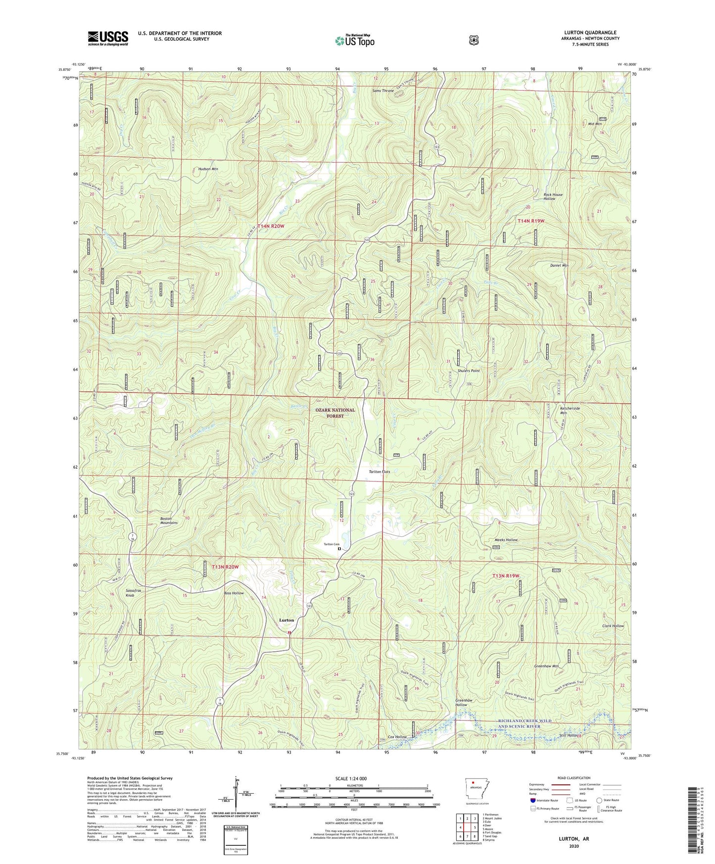
Lurton Arkansas US Topo Map
Couldn't load pickup availability
Also explore the Lurton Forest Service Topo of this same quad for updated USFS data
2024 topographic map quadrangle Lurton in the state of Arkansas. Scale: 1:24000. Based on the newly updated USGS 7.5' US Topo map series, this map is in the following counties: Newton. The map contains contour data, water features, and other items you are used to seeing on USGS maps, but also has updated roads and other features. This is the next generation of topographic maps. Printed on high-quality waterproof paper with UV fade-resistant inks.
Quads adjacent to this one:
West: Deer
Northwest: Parthenon
North: Mount Judea
Northeast: Eula
East: Moore
Southeast: Smyrna
South: Sand Gap
Southwest: Fort Douglas
This map covers the same area as the classic USGS quad with code o35093g1.
Contains the following named places: Battle Creek, Campbell Creek, Cow Creek, Cox Hollow, Dan Heffley Branch, Daniel Mountain, Falls Branch, Greenhaw Hollow, Greenhaw Mountain, Hamilton School, Holt, Hudson Mountain, Ketcherside Fire Tower, Ketcherside Mountain, Lurton, Lurton - Pelsor Rural Fire Department, Macedonia School, Middle Mountain, Rock House Hollow, Sams Throne, Sassafras Knob, Shulers Point, Spence Jucntion, Still Hollow, Tarlton Cemetery, Tarlton Flats, Tilly Creek, Township of Big Creek, Township of Richland, ZIP Code: 72856