MyTopo
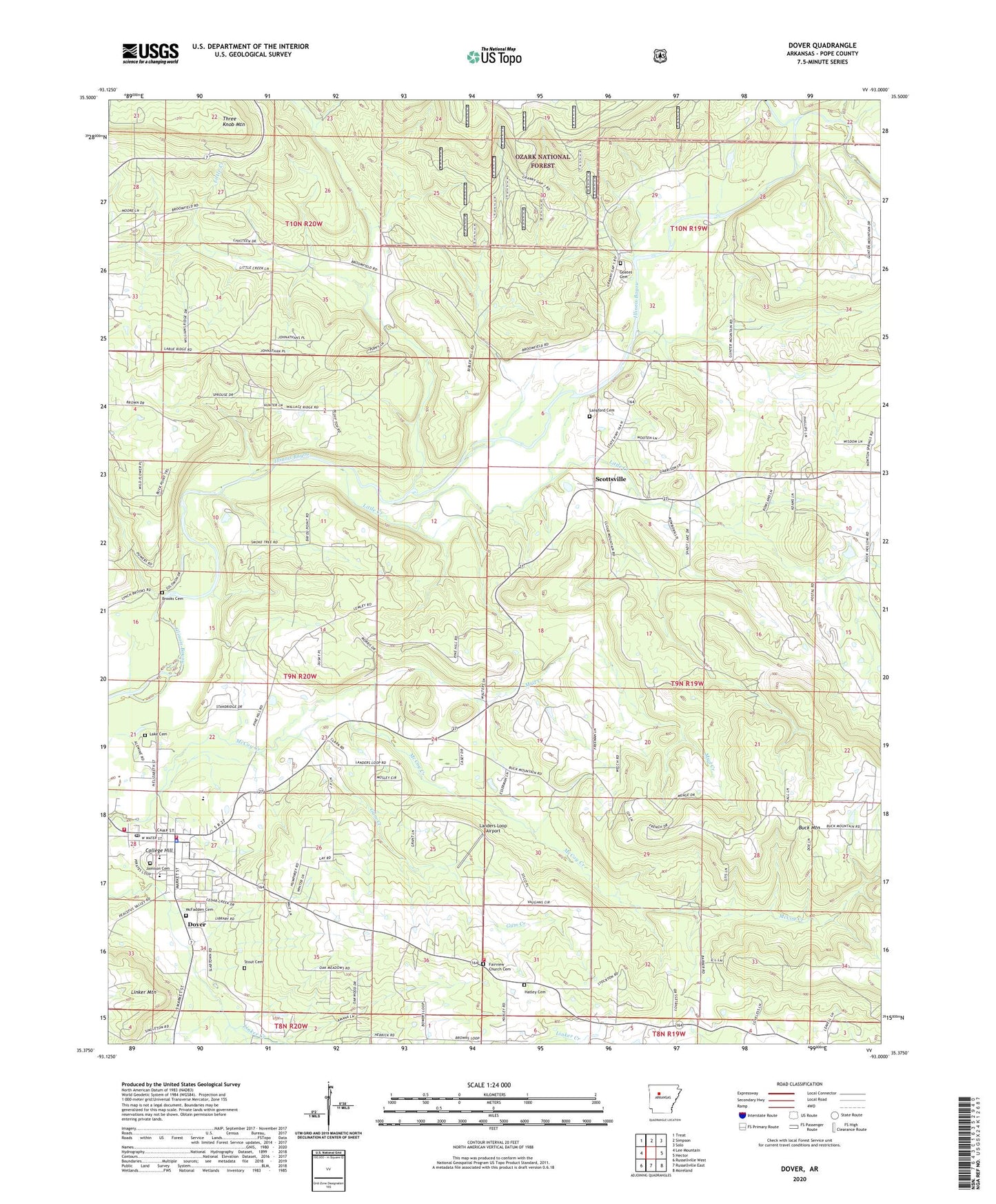
Dover Arkansas US Topo Map
Couldn't load pickup availability
Also explore the Dover Forest Service Topo of this same quad for updated USFS data
2024 topographic map quadrangle Dover in the state of Arkansas. Scale: 1:24000. Based on the newly updated USGS 7.5' US Topo map series, this map is in the following counties: Pope. The map contains contour data, water features, and other items you are used to seeing on USGS maps, but also has updated roads and other features. This is the next generation of topographic maps. Printed on high-quality waterproof paper with UV fade-resistant inks.
Quads adjacent to this one:
West: Lee Mountain
Northwest: Treat
North: Simpson
Northeast: Solo
East: Hector
Southeast: Moreland
South: Russellville East
Southwest: Russellville West
This map covers the same area as the classic USGS quad with code o35093d1.
Contains the following named places: Brooks Cemetery, Broomfield, Broomfield Church, Cedar Grove Assembly of God Church, City of Dover, College Hill, Cottonwood School, Dover, Dover City Fire and Rescue, Dover College, Dover Elementary School, Dover Gas Field, Dover High School, Dover Middle School, Dover Police Department, Dover Post Office, Dover Primary School, Dover Rural Fire Department, Dover Work Center, Fairview Church Cemetery, Goates Cemetery, Gum Creek, Hatley Baptist Church, Hatley Cemetery, Hatley School, Hatley Volunteer Fire Department, Jamison Cemetery, Lake Cemetery, Landers Loop Airport, Langford Cemetery, Little Creek, McFadden Cemetery, Mill Creek, Mud Creek, Newton School, Newton Springs Church, North Fork Illinois Bayou, Phoenix Church, Phoenix School, Pine Hill Chapel, Pine Hill School, Pope County, Pope County Emergency Medical Service Station 4, Price Grove Church, Prices Grove School, Scottsville, Scottsville Gas Field, Stout Cemetery, Three Knob Mountain, Township of Dover, Township of Phoenix