MyTopo
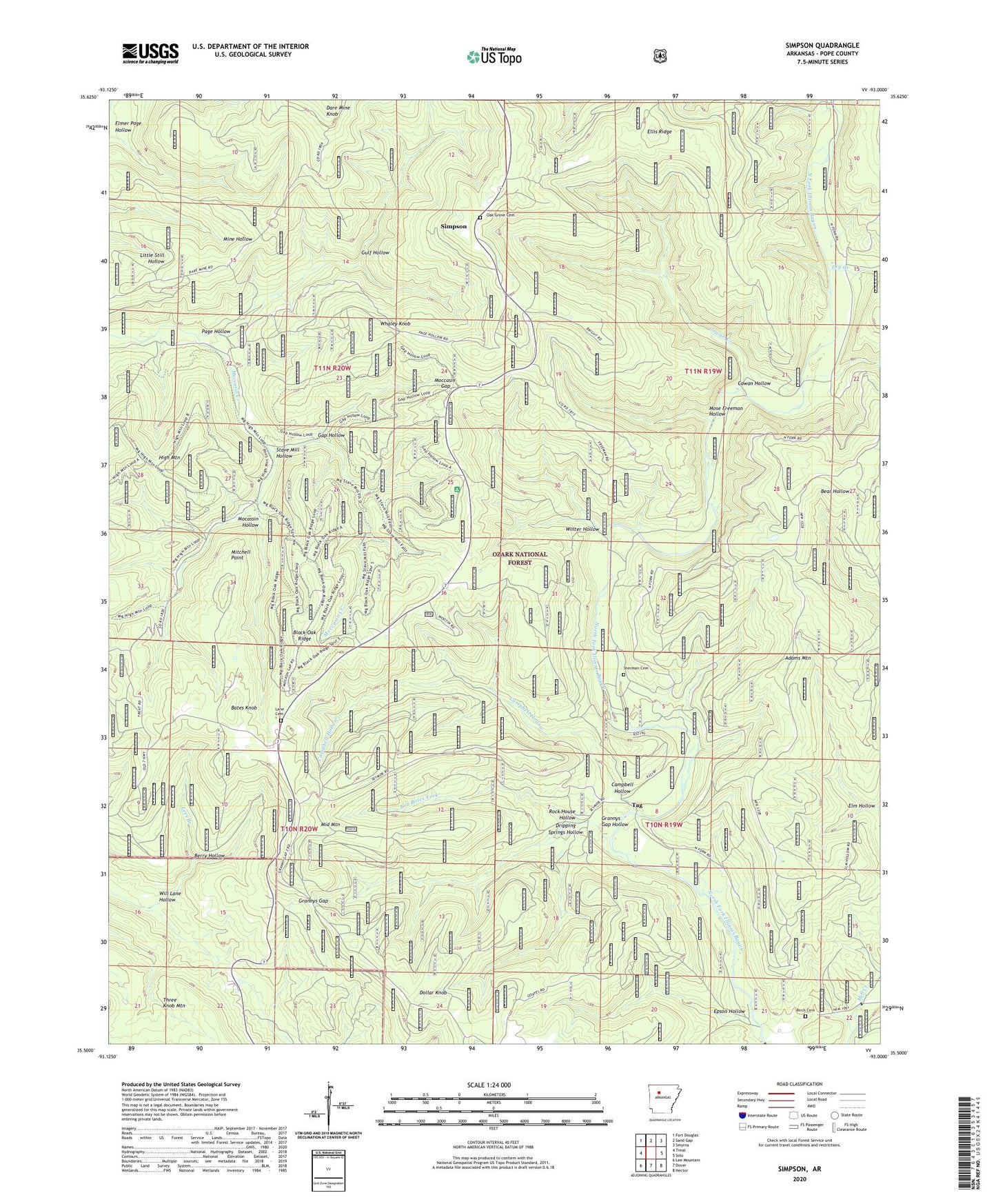
Simpson Arkansas US Topo Map
Couldn't load pickup availability
Also explore the Simpson Forest Service Topo of this same quad for updated USFS data
2024 topographic map quadrangle Simpson in the state of Arkansas. Scale: 1:24000. Based on the newly updated USGS 7.5' US Topo map series, this map is in the following counties: Pope. The map contains contour data, water features, and other items you are used to seeing on USGS maps, but also has updated roads and other features. This is the next generation of topographic maps. Printed on high-quality waterproof paper with UV fade-resistant inks.
Quads adjacent to this one:
West: Treat
Northwest: Fort Douglas
North: Sand Gap
Northeast: Smyrna
East: Solo
Southeast: Hector
South: Dover
Southwest: Lee Mountain
This map covers the same area as the classic USGS quad with code o35093e1.
Contains the following named places: Adams Mountain, Bates Knob, Berry Hollow, Birch Cemetery, Black Oak Ridge, Bob Bates Fork, Bursh School, Campbell Hollow, Cowan Creek, Cowan Hollow, Cowan Hollow Trail, Cowan Spring School, Dollar Knob, Dripping Springs Hollow, Dry Creek, Ellis Ridge, Elm Hollow, Elmer Page Hollow, Epson Hollow, Gap Hollow, Grannys Gap, Grannys Gap Hollow, Gulf Hollow, High Mountain, Ladd School Number 2, Lane Cemetery, Laurel, Macassin Hollow, Middle Mountain, Mineral Spring School, Mitchell Point, Mocassin Hollow, Moccasin Gap, Mose Freeman Hollow, Mount Pleasant School, Oak Grove Cemetery, Oak Grove School, Page Hollow, Rock House Hollow, Sherman Cemetery, Simpson, Stave Mill Hollow, Tag, Township of Hogan, Township of Liberty, Township of North Fork, West Fork Illinois Bayou, West Fork North Fork Illinois Bayou, Whaley Knob, Will Lane Hollow, Winter Hollow, ZIP Code: 72837