MyTopo
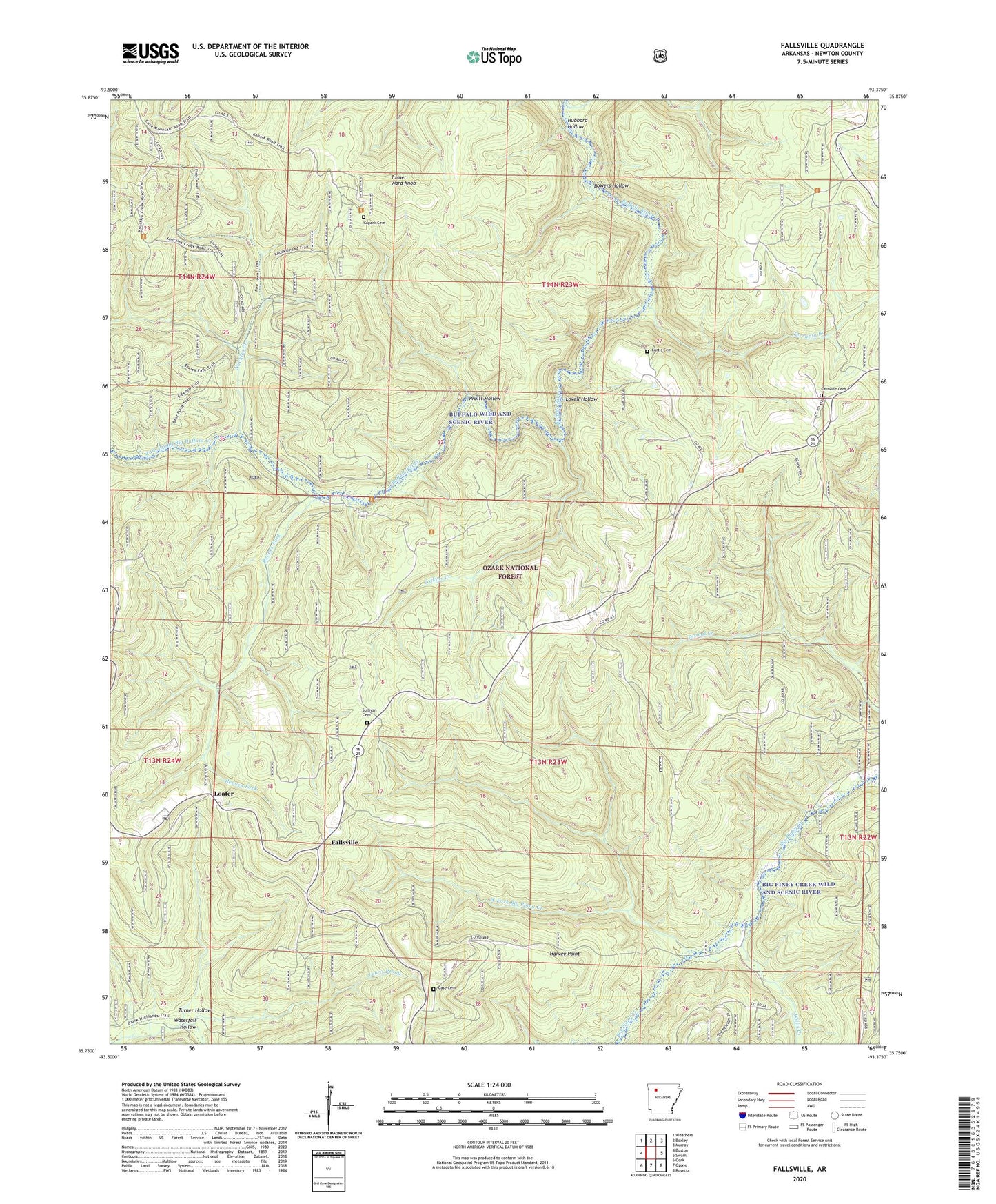
Fallsville Arkansas US Topo Map
Couldn't load pickup availability
Also explore the Fallsville Forest Service Topo of this same quad for updated USFS data
2024 topographic map quadrangle Fallsville in the state of Arkansas. Scale: 1:24000. Based on the newly updated USGS 7.5' US Topo map series, this map is in the following counties: Newton. The map contains contour data, water features, and other items you are used to seeing on USGS maps, but also has updated roads and other features. This is the next generation of topographic maps. Printed on high-quality waterproof paper with UV fade-resistant inks.
Quads adjacent to this one:
West: Boston
Northwest: Weathers
North: Boxley
Northeast: Murray
East: Swain
Southeast: Rosetta
South: Ozone
Southwest: Oark
This map covers the same area as the classic USGS quad with code o35093g4.
Contains the following named places: Adkins Creek, Boen Gulf Branch, Bowers Hollow, Buffalo Lookout Tower, Buffalo Wild and Scenic River, Case Cemetery, Cassville Cemetery, Cassville Church, Curtis Cemetery, Fallsville, Harvey Point, Hubbard Hollow, Kapark Cemetery, Loafer, Lovell Hollow, Main Prong Big Buffalo Creek, Nuckles Creek, Pruitt Hollow, Reeves Fork, Roberts Gap Church, Sullivan Cemetery, Terrapin Branch, Township of Boston, Turner Hollow, Turner Ward Knob, Upper Buffalo Wilderness, Waterfall Hollow, West Fork Big Piney Creek, Willis Creek