MyTopo
Garner Arkansas US Topo Map
Couldn't load pickup availability
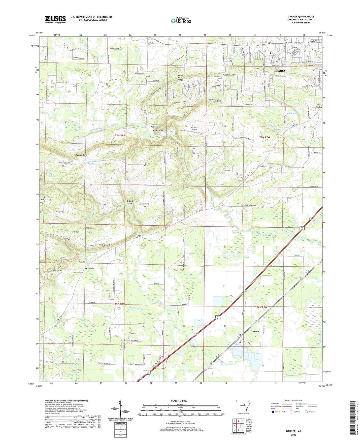
2024 topographic map quadrangle Garner in the state of Arkansas. Scale: 1:24000. Based on the newly updated USGS 7.5' US Topo map series, this map is in the following counties: White. The map contains contour data, water features, and other items you are used to seeing on USGS maps, but also has updated roads and other features. This is the next generation of topographic maps. Printed on high-quality waterproof paper with UV fade-resistant inks.
Quads adjacent to this one:
West: Floyd
Northwest: Sidon
North: Letona
Northeast: Judsonia
East: Kensett
Southeast: Walker
South: McRae
Southwest: Beebe
This map covers the same area as the classic USGS quad with code o35091b7.
Contains the following named places: Cobbite Branch, Copperas Springs Church, Fly "N" K Airport, Garner, Garner Post Office, Garner School, Garner Volunteer Fire Department, Gilbert Hollow, Gum Springs Cemetery, Gum Springs United Methodist Church, Gum Springs Volunteer Fire Department, Hazelwood Branch, Honey Hill Church, Honey Hill Heliport, Honey Hill Ridge, Jarta, Jaybird Branch, Jaybird Hollow, Lercher Lake Number One, Lercher Lake Number One Dam, McKown Slough, Mossy Point, Northstar Emergency Medical Service - Searcy Station 2, Peanut Ridge, Pine Run, Rodman Branch, Rodman Hill, Schroeder Lake, Schroeder Lake Two Dam, Searcy Country Club, Searcy Fire Department Station 3, Second Baptist Church, Shiloh Branch, Sixteenth Section Church, Slayton Branch, Smith Pond, Swan Ponds, Town of Garner, Township of Cane, Township of Gum Springs, Weir Cemetery, Westside Elementary School, ZIP Code: 72102