MyTopo
Forum Arkansas US Topo Map
Couldn't load pickup availability
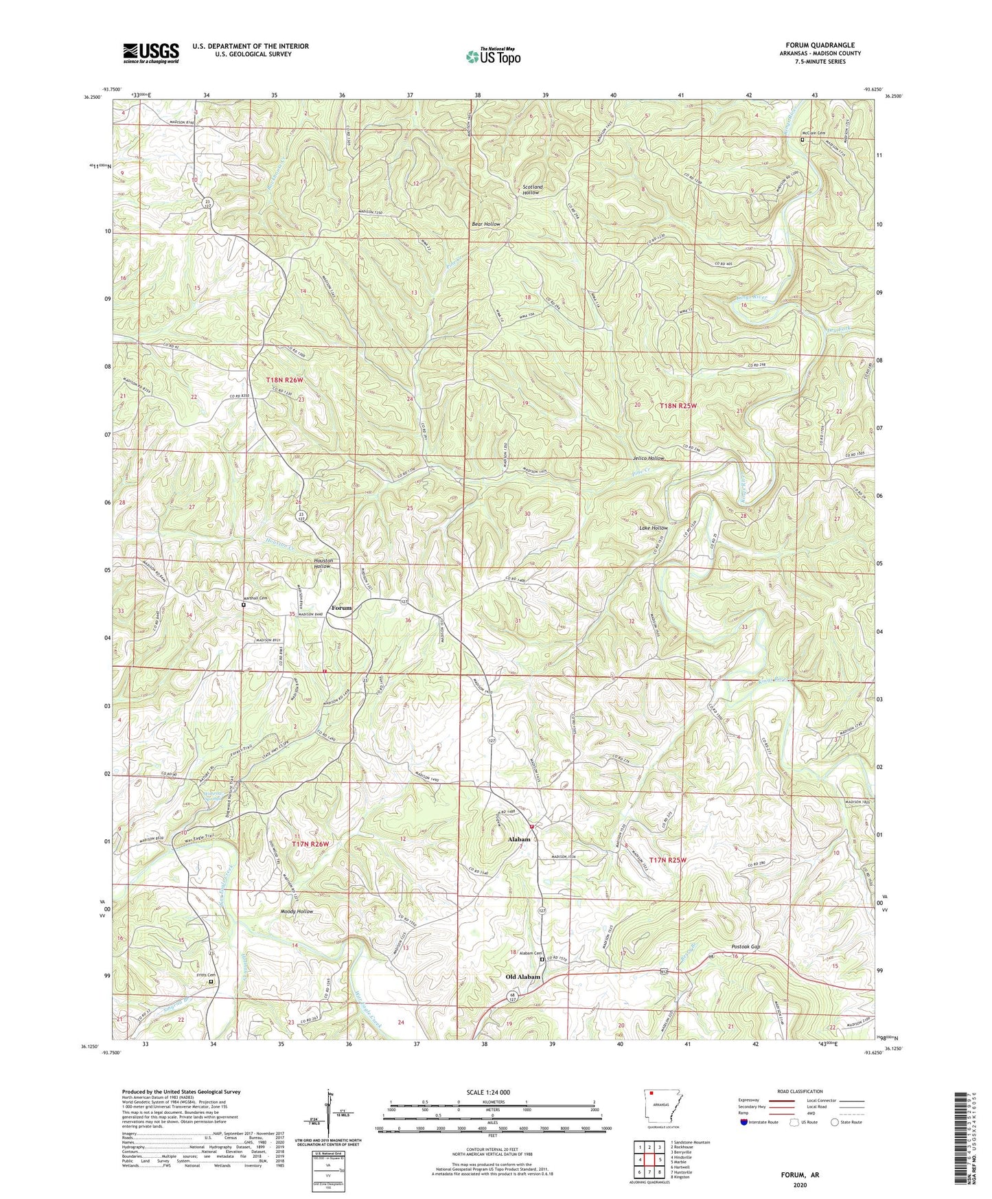
2024 topographic map quadrangle Forum in the state of Arkansas. Scale: 1:24000. Based on the newly updated USGS 7.5' US Topo map series, this map is in the following counties: Madison. The map contains contour data, water features, and other items you are used to seeing on USGS maps, but also has updated roads and other features. This is the next generation of topographic maps. Printed on high-quality waterproof paper with UV fade-resistant inks.
Quads adjacent to this one:
West: Hindsville
Northwest: Sandstone Mountain
North: Rockhouse
Northeast: Berryville
East: Marble
Southeast: Kingston
South: Huntsville
Southwest: Hartwell
This map covers the same area as the classic USGS quad with code o36093b6.
Contains the following named places: Alabam, Alabam Cemetery, Alabam School, Assembly of God Church, Chaplin, Dry Fork, Forum, Forum - Alabam Volunteer Fire Department Station 1, Forum / Alabam Volunteer Fire Department, Forum Lookout Tower, Forum Post Office, Fritts Cemetery, Holman Creek, Jelico Hollow, Lake Hollow, Marshall Cemetery, McClain Cemetery, McIlroy State Game Management Area, Moody Hollow, Noark Camp, Old Alabam, Pine Creek, Postoak Gap, Smyrna Branch, Township of Alabam, Township of Piney, Withrow Springs, Withrow Springs State Park