MyTopo
Marble Arkansas US Topo Map
Couldn't load pickup availability
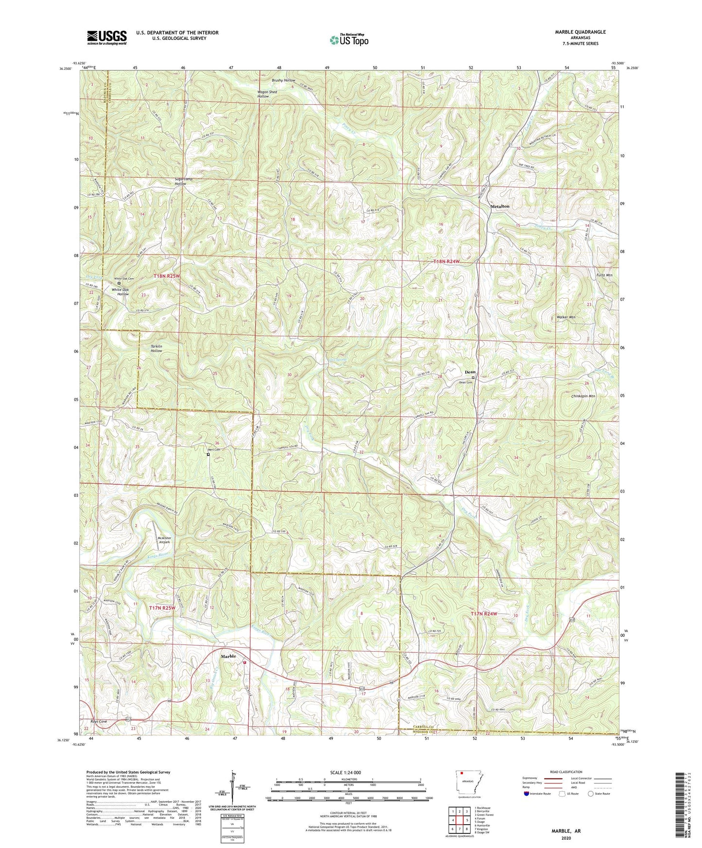
2024 topographic map quadrangle Marble in the state of Arkansas. Scale: 1:24000. Based on the newly updated USGS 7.5' US Topo map series, this map is in the following counties: Carroll, Madison. The map contains contour data, water features, and other items you are used to seeing on USGS maps, but also has updated roads and other features. This is the next generation of topographic maps. Printed on high-quality waterproof paper with UV fade-resistant inks.
Quads adjacent to this one:
West: Forum
Northwest: Rockhouse
North: Berryville
Northeast: Green Forest
East: Osage
Southeast: Osage SW
South: Kingston
Southwest: Huntsville
This map covers the same area as the classic USGS quad with code o36093b5.
Contains the following named places: Big Onion Creek, Brushy Hollow, Cave Spring, Cedar Creek, Chinkapin Mountain, Dean, Dean Cemetery, Dean School, Lower Campground Church, Marble, Marble Volunteer Fire Department, McAlister Airpark, Merl Cemetery, Metalton, Rays Cove, Sites Branch, Smith Heliport, Tarkiln Hollow, Township of Omega, Wagon Shed Hollow, Walker Mountain, White Oak Cemetery, White Oak Church, White Oak Hollow, Wolf Pen