MyTopo
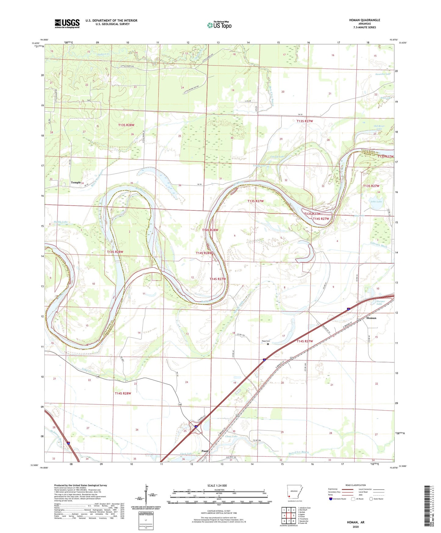
Homan Arkansas US Topo Map
Couldn't load pickup availability
2024 topographic map quadrangle Homan in the state of Arkansas. Scale: 1:24000. Based on the newly updated USGS 7.5' US Topo map series, this map is in the following counties: Miller, Little River. The map contains contour data, water features, and other items you are used to seeing on USGS maps, but also has updated roads and other features. This is the next generation of topographic maps. Printed on high-quality waterproof paper with UV fade-resistant inks.
Quads adjacent to this one:
West: Ogden
Northwest: Ashdown East
North: Red Bluff
Northeast: McNab
East: Fulton
Southeast: Fouke NE
South: Mandeville
Southwest: Texarkana
This map covers the same area as the classic USGS quad with code o33093e8.
Contains the following named places: Bear Lake, Brush Lake, Cedar Creek, Clark Lake, Clear Lake, Clear Lake Junction, Cut-off Lake, Gillespie Ditch, Harper Lake, Homan, Homan Ditch, Horseshoe Lake, Muddy Lake, Old River Lake, Paup, Paup Cemetery, Silver Lake, Temple, Tobe Lake, Township of Homan, Township of Johnson, Young Lake, ZIP Code: 71853