MyTopo
Gethsemane Arkansas US Topo Map
Couldn't load pickup availability
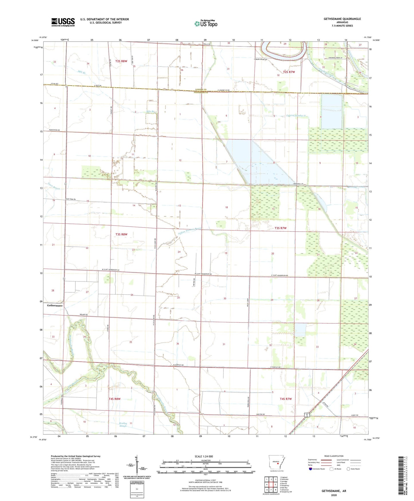
2024 topographic map quadrangle Gethsemane in the state of Arkansas. Scale: 1:24000. Based on the newly updated USGS 7.5' US Topo map series, this map is in the following counties: Jefferson, Lonoke. The map contains contour data, water features, and other items you are used to seeing on USGS maps, but also has updated roads and other features. This is the next generation of topographic maps. Printed on high-quality waterproof paper with UV fade-resistant inks.
Quads adjacent to this one:
West: Sherrill
Northwest: England
North: Humnoke
Northeast: Geridge
East: Humphrey
Southeast: Humphrey SW
South: Altheimer
Southwest: Rob Roy
This map covers the same area as the classic USGS quad with code o34091d7.
Contains the following named places: Bogey School, Coburn Brake, Coleman Chapel, Coon Bayou, Coy Landing Strip, Diantha, Flat Bayou, Gethsemane, Gethsemane Church, Gethsemane School, Henderson Landing Strip, Indian Woman Bayou, Jerusalem Church, Jerusalem School, Lateral Number 8, Lateral Number 9, McClung School, Mile Branch, Oak Grove Church, Oak Grove School, Saint Lukes Church, Saint Stephen Church, Township of Roberts, Wabbaseka Church