MyTopo
Humnoke Arkansas US Topo Map
Couldn't load pickup availability
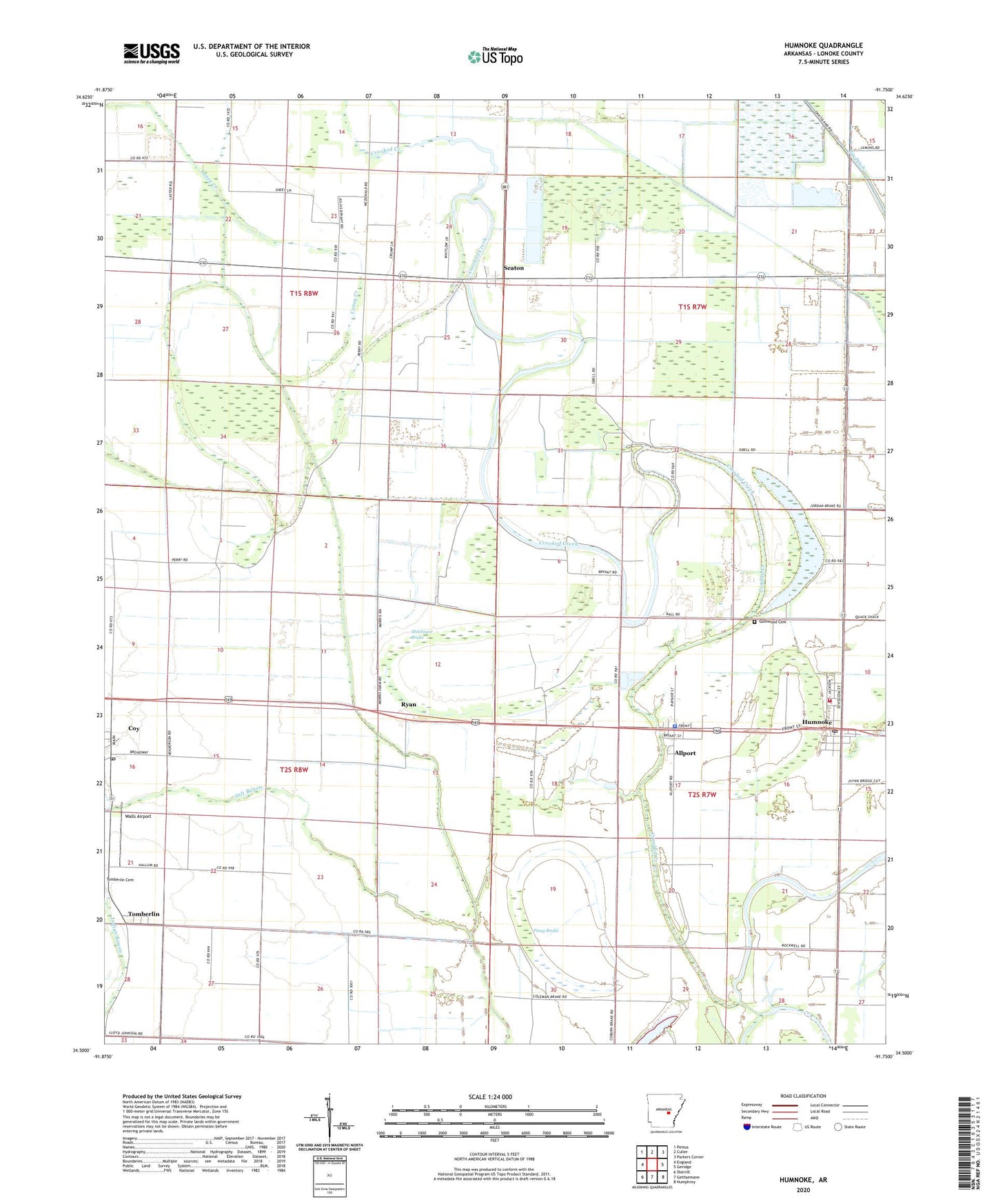
2024 topographic map quadrangle Humnoke in the state of Arkansas. Scale: 1:24000. Based on the newly updated USGS 7.5' US Topo map series, this map is in the following counties: Lonoke. The map contains contour data, water features, and other items you are used to seeing on USGS maps, but also has updated roads and other features. This is the next generation of topographic maps. Printed on high-quality waterproof paper with UV fade-resistant inks.
Quads adjacent to this one:
West: England
Northwest: Pettus
North: Culler
Northeast: Parkers Corner
East: Geridge
Southeast: Humphrey
South: Gethsemane
Southwest: Sherrill
This map covers the same area as the classic USGS quad with code o34091e7.
Contains the following named places: Allport, Allport Police Department, Bakers Bayou, Buffalo School, Campbell Church, Caney Creek, City of Humnoke, Coy, Coy Fire Department, Coy Post Office, Elm Grove Church, Gumwood Cemetery, Humnoke, Humnoke Elementary School, Humnoke High School, Humnoke Police Department, Humnoke Post Office, Humnoke Volunteer Fire Department, Jordan Brake, McGregor Brake, Oak Grove Church, Oak Grove School, Oakgrove Church, Perrys Chapel, Piney Brake, Rowes Chapel, Ryan, Salt Bayou, Seaton, Springfield Church, Tomberlin, Tomberlin Church, Town of Allport, Town of Coy, Township of Crooked Creek, Township of Fletcher, Township of Indian Bayou, Walls Airport, ZIP Code: 72037