MyTopo
Geridge Arkansas US Topo Map
Couldn't load pickup availability
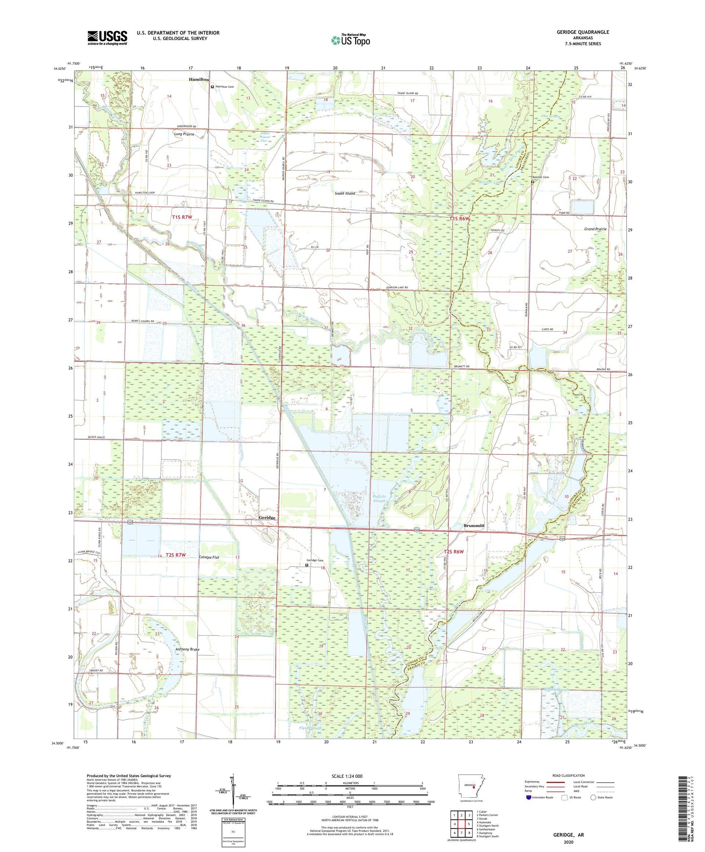
2024 topographic map quadrangle Geridge in the state of Arkansas. Scale: 1:24000. Based on the newly updated USGS 7.5' US Topo map series, this map is in the following counties: Lonoke, Prairie. The map contains contour data, water features, and other items you are used to seeing on USGS maps, but also has updated roads and other features. This is the next generation of topographic maps. Printed on high-quality waterproof paper with UV fade-resistant inks.
Quads adjacent to this one:
West: Humnoke
Northwest: Culler
North: Parkers Corner
Northeast: Slovak
East: Stuttgart North
Southeast: Stuttgart South
South: Humphrey
Southwest: Gethsemane
This map covers the same area as the classic USGS quad with code o34091e6.
Contains the following named places: Anthony Brake, Bayou Two Prairie, Belcher Cemetery, Belcher Lake, Big Ditch, Brummitt, Brummitt School, Brushy Slough, Buffalo Slough, Catalpa Flat, Crooked Creek Ditch, Dennis Slough, Fairmount School, Geridge, Geridge Cemetery, Gum Swamp, Hamilton, Hamilton Church, Hamilton School, Hamilton United Methodist Church Cemetery, Isbell School, Johnson Lake, KZIX-FM (Humnoke), Leighton, Seaton Dump, Snake Island, Snake Island Church, Snake Island Flat, Township of Belcher, Township of Isbell, ZIP Code: 72072