MyTopo
Humphrey Arkansas US Topo Map
Couldn't load pickup availability
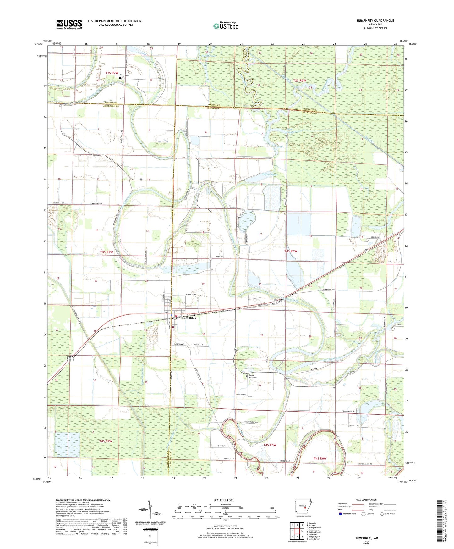
2024 topographic map quadrangle Humphrey in the state of Arkansas. Scale: 1:24000. Based on the newly updated USGS 7.5' US Topo map series, this map is in the following counties: Arkansas, Jefferson, Lonoke, Prairie. The map contains contour data, water features, and other items you are used to seeing on USGS maps, but also has updated roads and other features. This is the next generation of topographic maps. Printed on high-quality waterproof paper with UV fade-resistant inks.
Quads adjacent to this one:
West: Gethsemane
Northwest: Humnoke
North: Geridge
Northeast: Stuttgart North
East: Stuttgart South
Southeast: Lodge Corner
South: Humphrey SW
Southwest: Altheimer
This map covers the same area as the classic USGS quad with code o34091d6.
Contains the following named places: Argo Chapel, Bayou Meto Cemetery, Bayou Meto Church, Bear Slough, Big Slough, City of Humphrey, Crooked Creek, Cutoff, Cutoff Church, Cut-Off School, Flynn Cemetery, Flynn Church, Flynn School, Flynn Slough, Gill School, Glenwood Lake, Hufford Brake, Humphrey, Humphrey Elementary School, Humphrey Fire Department, Humphrey High School, Humphrey Municipal Fire Department Substation 1, Humphrey Police Department, Humphrey Post Office, Kratnek, Lateral Number 3, Lateral Number 5, Lateral Number 7, Pleasant Valley Church, Randolph Reservoir, Randolph Reservoir Dam, Roberts, Salt Bayou Drainage Ditch, Township of Henton, Turner Store, ZIP Code: 72073