MyTopo
Gillham Arkansas US Topo Map
Couldn't load pickup availability
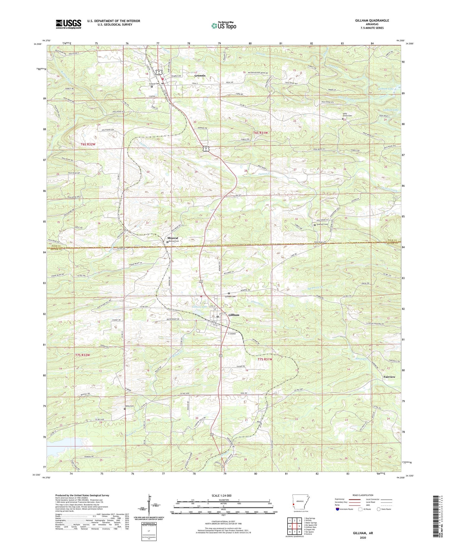
2024 topographic map quadrangle Gillham in the state of Arkansas. Scale: 1:24000. Based on the newly updated USGS 7.5' US Topo map series, this map is in the following counties: Sevier, Polk. The map contains contour data, water features, and other items you are used to seeing on USGS maps, but also has updated roads and other features. This is the next generation of topographic maps. Printed on high-quality waterproof paper with UV fade-resistant inks.
Quads adjacent to this one:
West: De Queen NW
Northwest: Bog Springs
North: Wickes
Northeast: Baker Springs
East: Gillham Dam
Southeast: Geneva
South: De Queen
Southwest: Chapel Hill
This map covers the same area as the classic USGS quad with code o34094b3.
Contains the following named places: Aeration Lake, Allen Branch, Almond Church, Antioch, Antioch School, City of Grannis, Fairview, Fairview School, Gillham, Gillham Cemetery, Gillham High School, Gillham Lake, Gillham Lake Dam, Gillham Post Office, Gillham Volunteer Fire Department, Grannis, Grannis Baptist Church, Grannis Cemetery, Grannis Fire Station 1, Grannis Police Department, Grannis Post Office, Holly Grove, Holly Grove Cemetery, Holly Grove Missionary Baptist Church, Holly Grove School, Holly Springs Church, King, Land Processing Lake Dam, Little Coon Creek, Mineral, Mineral Cemetery, Overturf Cemetery, Overturf Church, Overturf School, Ozark School, School Number 47, Spring Hill School, Town of Gillham, Township of Mineral, Valley Cemetery, Valley School, ZIP Codes: 71841, 71944