MyTopo
Wickes Arkansas US Topo Map
Couldn't load pickup availability
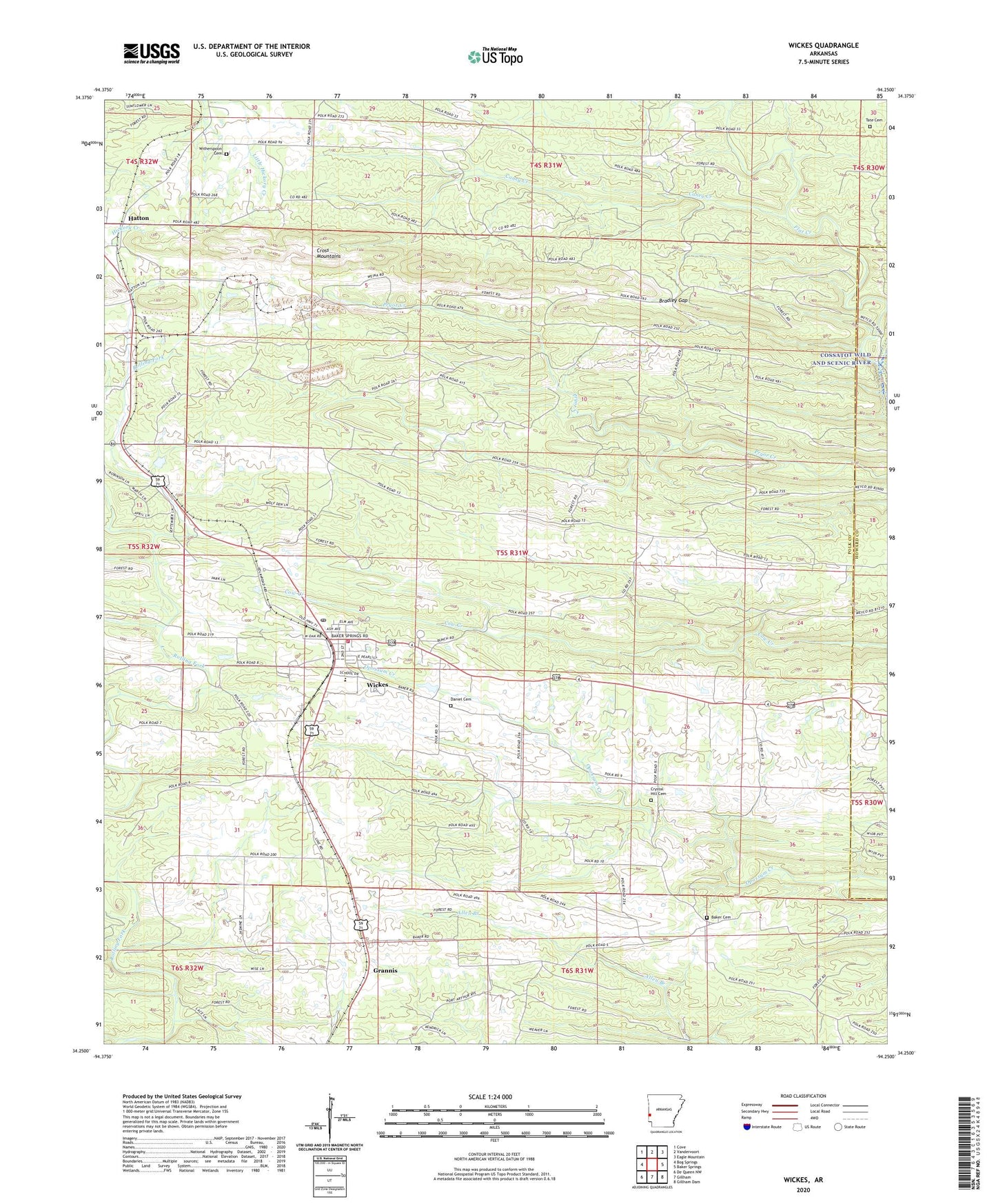
2024 topographic map quadrangle Wickes in the state of Arkansas. Scale: 1:24000. Based on the newly updated USGS 7.5' US Topo map series, this map is in the following counties: Polk, Howard. The map contains contour data, water features, and other items you are used to seeing on USGS maps, but also has updated roads and other features. This is the next generation of topographic maps. Printed on high-quality waterproof paper with UV fade-resistant inks.
Quads adjacent to this one:
West: Bog Springs
Northwest: Cove
North: Vandervoort
Northeast: Eagle Mountain
East: Baker Springs
Southeast: Gillham Dam
South: Gillham
Southwest: De Queen NW
This map covers the same area as the classic USGS quad with code o34094c3.
Contains the following named places: Arkwild Camp, Baker Cemetery, Baker Church, Baker School, Bowmans Spur School, Bradley Gap, Brewer Lake, Brewer Lake Dam, Bunch School, Caney Creek, Crystal Hill Cemetery, Crystal Hill Church, Crystal Hill School, Daniel Cemetery, Flat Creek, Hatton, Jenkins Lake, Jenkins Lake Dam, Pleasant Hill Church, Shiloh School, Tate Cemetery, Town of Wickes, Township of Ozark, Township of White, United Church of Grannis, Wickes, Wickes Elementary School, Wickes Fire Department, Wickes High School, Wickes Middle School, Wickes Post Office, Witherspoon Cemetery, Womack Spur School, ZIP Code: 71973