MyTopo
Baker Springs Arkansas US Topo Map
Couldn't load pickup availability
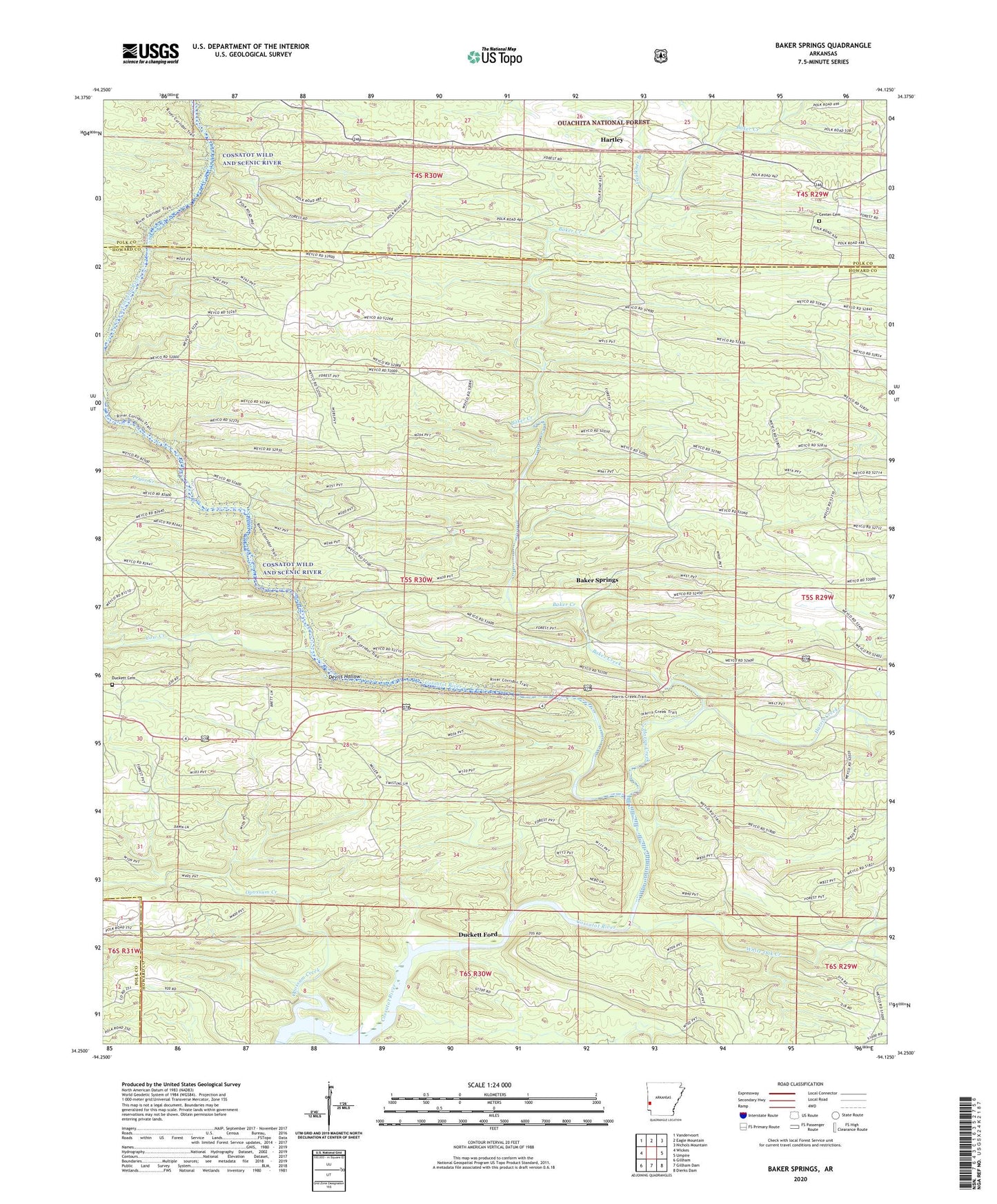
2024 topographic map quadrangle Baker Springs in the state of Arkansas. Scale: 1:24000. Based on the newly updated USGS 7.5' US Topo map series, this map is in the following counties: Howard, Polk. The map contains contour data, water features, and other items you are used to seeing on USGS maps, but also has updated roads and other features. This is the next generation of topographic maps. Printed on high-quality waterproof paper with UV fade-resistant inks.
Quads adjacent to this one:
West: Wickes
Northwest: Vandervoort
North: Eagle Mountain
Northeast: Nichols Mountain
East: Umpire
Southeast: Dierks Dam
South: Gillham Dam
Southwest: Gillham
This map covers the same area as the classic USGS quad with code o34094c2.
Contains the following named places: Baker Creek, Baker Ford, Baker Springs, Center Cemetery, Center Church, Center School, Church Ford, Cow Creek, Cow Creek Ford, Devils Hollow, Duckett, Duckett Cemetery, Duckett Ford, Faulkner Branch, Happy Hill School, Harris Creek, Hartley, Mineral Branch School, Opossum Creek, Planner Ford, Pryor Creek, Pryor Ford, Pryor Ridge, Pryor Ridge School, Rankin Ford, Scrougeout School, Shiloh School, Township of Baker, Township of Duckett, Township of Umpire, White Oak Creek