MyTopo
Hampton Arkansas US Topo Map
Couldn't load pickup availability
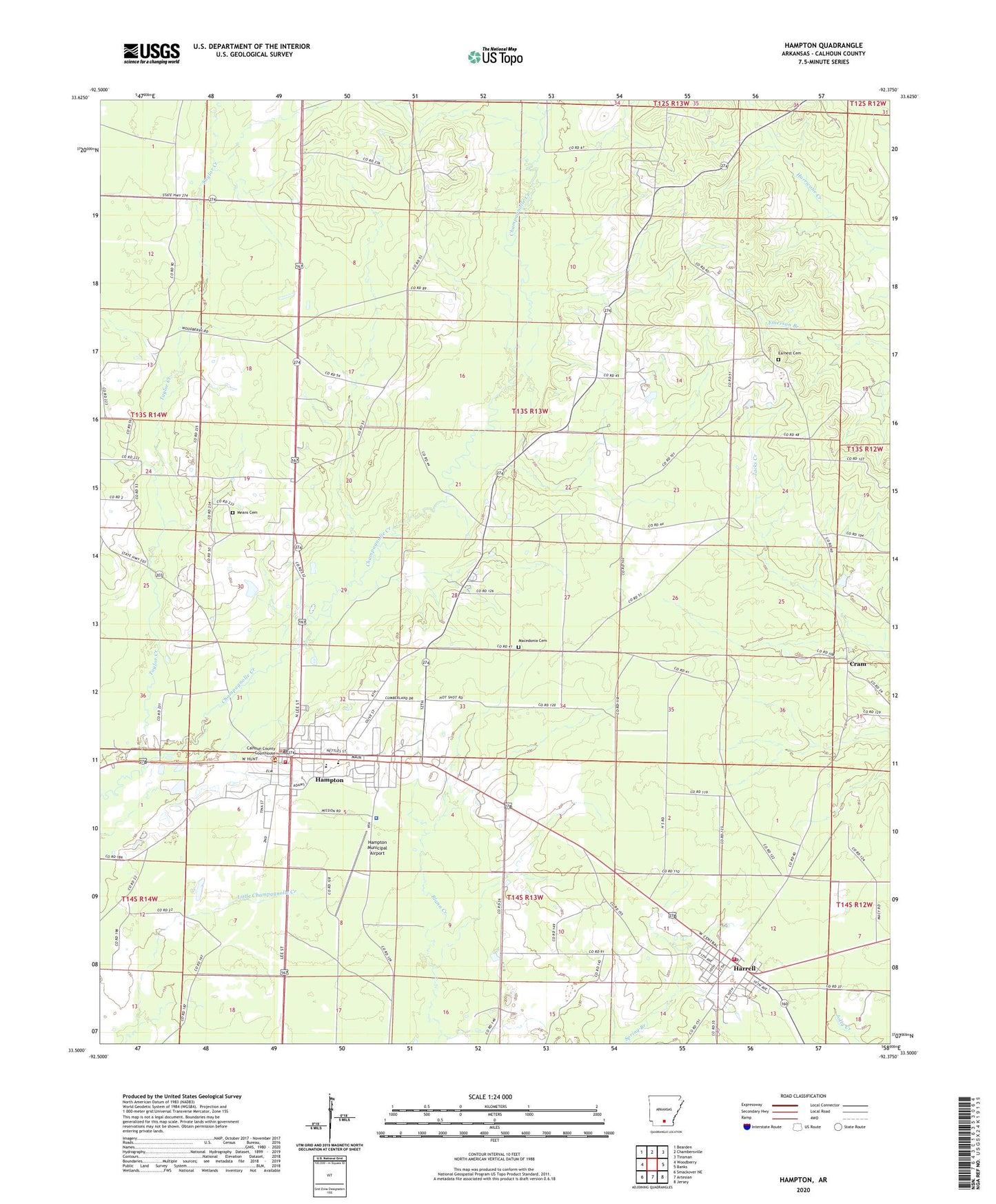
2024 topographic map quadrangle Hampton in the state of Arkansas. Scale: 1:24000. Based on the newly updated USGS 7.5' US Topo map series, this map is in the following counties: Calhoun. The map contains contour data, water features, and other items you are used to seeing on USGS maps, but also has updated roads and other features. This is the next generation of topographic maps. Printed on high-quality waterproof paper with UV fade-resistant inks.
Quads adjacent to this one:
West: Woodberry
Northwest: Bearden
North: Chambersville
Northeast: Tinsman
East: Banks
Southeast: Jersey
South: Artesian
Southwest: Smackover NE
This map covers the same area as the classic USGS quad with code o33092e4.
Contains the following named places: Calhoun County Ambulance, Calhoun County Courthouse, Calhoun County Sheriff's Office, Campground Church, City of Hampton, Cram, Earnest Cemetery, Ham Moses Park, Hampton, Hampton Elementary School, Hampton Fire Station, Hampton High School, Hampton Municipal Airport, Hampton Police Department, Hampton Post Office, Harrell, Harrell Post Office, Harrell Volunteer Fire Department, Macedonia Cemetery, Means Cemetery, Taylor Creek, Town of Harrell, Township 8, Township 9, Union Church, ZIP Code: 71745