MyTopo
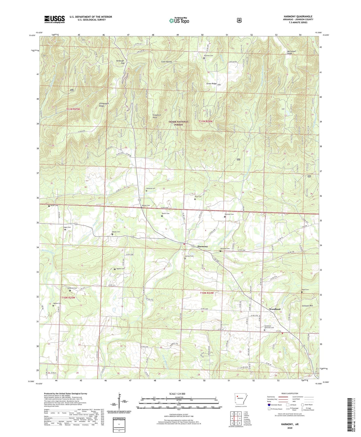
Harmony Arkansas US Topo Map
Couldn't load pickup availability
Also explore the Harmony Forest Service Topo of this same quad for updated USFS data
2024 topographic map quadrangle Harmony in the state of Arkansas. Scale: 1:24000. Based on the newly updated USGS 7.5' US Topo map series, this map is in the following counties: Johnson. The map contains contour data, water features, and other items you are used to seeing on USGS maps, but also has updated roads and other features. This is the next generation of topographic maps. Printed on high-quality waterproof paper with UV fade-resistant inks.
Quads adjacent to this one:
West: Hunt
Northwest: Yale
North: Oark
Northeast: Ozone
East: Ludwig
Southeast: Clarksville
South: Hartman
Southwest: Coal Hill
This map covers the same area as the classic USGS quad with code o35093e5.
Contains the following named places: Bethlehem Church, Bible Church, Chinquapin Ridge, Clarksville Gas Field, Cole Creek, Community Church, Cove Creek, Crawford Point, Dale, Edwards Cemetery, Grass Ridge, Harmony, Harmony Cemetery, Harmony Presbyterian Church, Hogan Cemetery, Johnson County Rural Fire Department Station 2 Harmony, Johnson County Rural Fire District 2 Woodland, Johnson Farm Lines Airport, Linville Gas Field, Lone Pine, Lone Pine Church, McConnell Ridge, McDaniel Cemetery, Naylor Cemetery, Ogilbie Cemetery, Porter Cemetery, Pryor Cemetery, Sherman Cemetery, Springhill Presbyterian Church, Township of Horsehead, Township of Low Gap, Watson Cemetery, Wood Cemetery, Woodland, Woodland Baptist Church, Woodland Memorial Cemetery, Yarbough Gap, Zachary Cemetery, ZIP Code: 72830