MyTopo
Coal Hill Arkansas US Topo Map
Couldn't load pickup availability
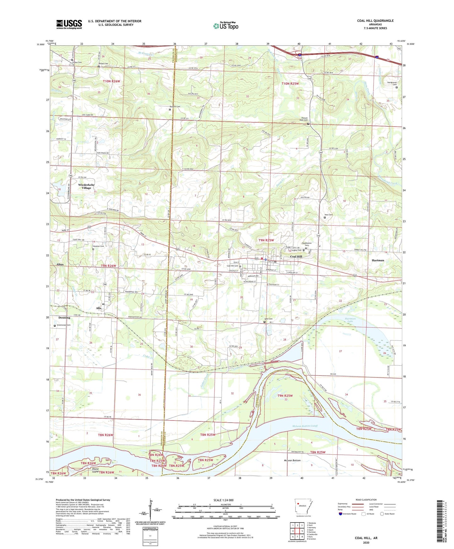
2024 topographic map quadrangle Coal Hill in the state of Arkansas. Scale: 1:24000. Based on the newly updated USGS 7.5' US Topo map series, this map is in the following counties: Johnson, Franklin, Logan. The map contains contour data, water features, and other items you are used to seeing on USGS maps, but also has updated roads and other features. This is the next generation of topographic maps. Printed on high-quality waterproof paper with UV fade-resistant inks.
Quads adjacent to this one:
West: Ozark
Northwest: Watalula
North: Hunt
Northeast: Harmony
East: Hartman
Southeast: Scranton
South: Paris
Southwest: Caulksville
This map covers the same area as the classic USGS quad with code o35093d6.
Contains the following named places: Alix, Alix Census Designated Place, Alix Gas Field, Alix Pond, Alix Post Office, Altus Gas Field, Assembly of God Church, Burnett Cemetery, Cedar Creek, Center Point, Center Point Missionary Baptist Church, Church of Christ, City of Coal Hill, Coal Hill, Coal Hill Cemetery, Coal Hill City Park, Coal Hill Gas Field, Coal Hill Police Department, Coal Hill Post Office, Coal Hill Volunteer Fire Department, Dirty Creek, East Fork Horsehead Creek, Ferguson Memorial Presbyterian Church, First Baptist Church, Forbus Cemetery, Free Full Gospel Church, Greenwood Cemetery, Hardgraves Cemetery, Hartman Lake, Hess Cemetery, Houston Cemetery, Huddleston Cemetery, Hurst Memorial Park, McKinney Creek, McLean Bottom Cutoff, Methodist Church, Patsy Creek, Philips Cemetery, Possum Walk Cemetery, Srygley Cemetery, Swiss Family Vineyards Dam, Swiss Family Vineyards Reservoir, Township of Alix, Township of Grant, Township of Lee, United Methodist Church, West Cemetery, Westside High School, Whippoorwill Church, ZIP Codes: 72821, 72832