MyTopo
Moro Bay Arkansas US Topo Map
Couldn't load pickup availability
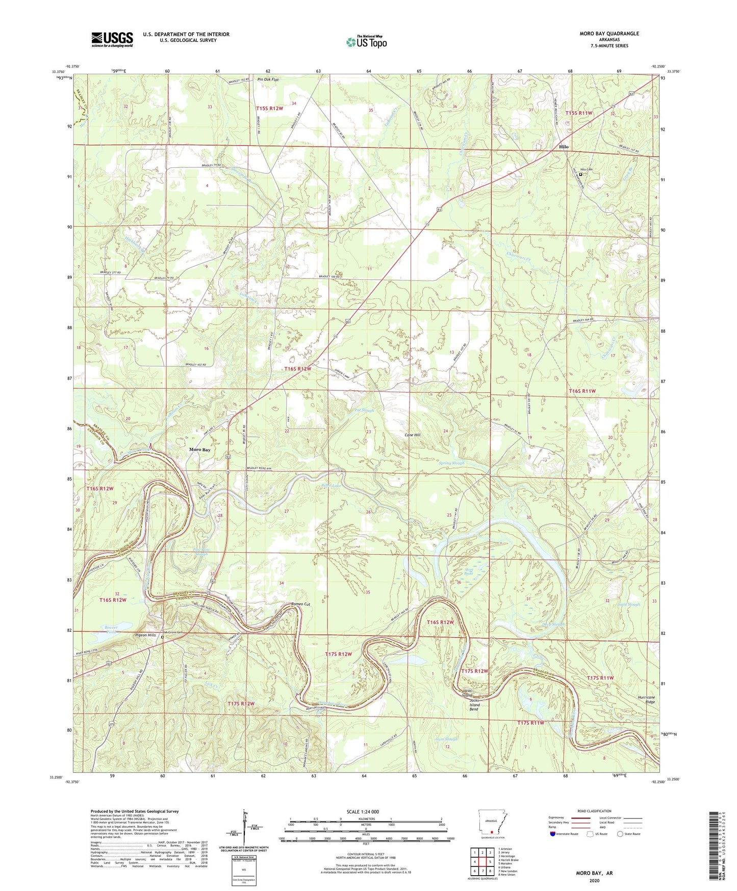
2024 topographic map quadrangle Moro Bay in the state of Arkansas. Scale: 1:24000. Based on the newly updated USGS 7.5' US Topo map series, this map is in the following counties: Bradley, Union, Calhoun. The map contains contour data, water features, and other items you are used to seeing on USGS maps, but also has updated roads and other features. This is the next generation of topographic maps. Printed on high-quality waterproof paper with UV fade-resistant inks.
Quads adjacent to this one:
West: Harrell Brake
Northwest: Artesian
North: Jersey
Northeast: Hermitage
East: Marsden
Southeast: New Union
South: New London
Southwest: Urbana
This map covers the same area as the classic USGS quad with code o33092c3.
Contains the following named places: Beaver Pond, Bilbo Lake, Cane Hill, Careyville Landing, Careyville Landing Oil Field, Deep Slough, Duncan Brake, Gray Branch, Green Island, Green Lake, Green Slough, Hilo, Hilo Cemetery, Hilo Church, Hilo School, Hurricane Ridge, Jacks Island, Jacks Island Bend, Kemp Island, LaBaum Creek, Lick Creek, Lick Creek Oil Field, Mayberry Brake, Moro Bay, Moro Bay First Methodist Episcopal Church, Moro Bay State Park, Moro Creek, Oak Grove Cemetery, Oak Grove Church, Pat Slough, Paw Paw Slough, Pigeon Hill, Pigeon Hill Oil Field, Pigeon Hill School, Pigeon Hills, Raymond Lake, River Bend Oil Field, Riverside School, Romeo Cut, Saint Matthew Church, Sand Slough, Short Brake, Spring Slough, Threemile Branch, Township of River, ZIP Code: 71651