MyTopo
Hawkins Arkansas US Topo Map
Couldn't load pickup availability
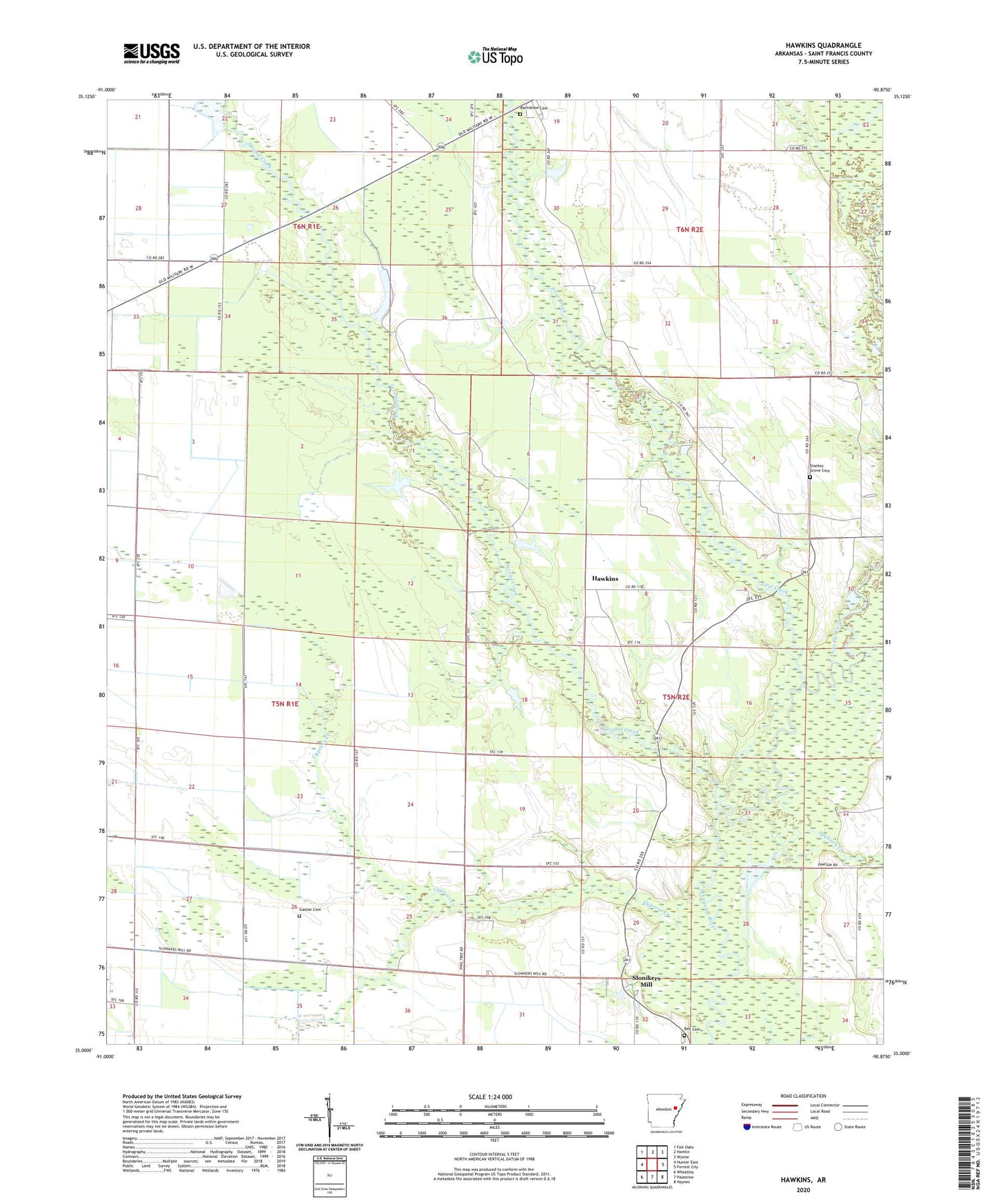
2024 topographic map quadrangle Hawkins in the state of Arkansas. Scale: 1:24000. Based on the newly updated USGS 7.5' US Topo map series, this map is in the following counties: St. Francis. The map contains contour data, water features, and other items you are used to seeing on USGS maps, but also has updated roads and other features. This is the next generation of topographic maps. Printed on high-quality waterproof paper with UV fade-resistant inks.
Quads adjacent to this one:
West: Hunter East
Northwest: Fair Oaks
North: Hamlin
Northeast: Wynne
East: Forrest City
Southeast: Haynes
South: Palestine
Southwest: Wheatley
This map covers the same area as the classic USGS quad with code o35090a8.
Contains the following named places: Barnishaw Cemetery, Bell Cemetery, Bethel Church, Center Grove Church, Cypress Creek, First Creek, Flournoy Church, Gaston Cemetery, Hawkins, Hawkins School, Hedge Providence Church, Johnson Chapel, Macedonia, Moonlight Church, Mount Zion Church, Second Creek, Slonikers Mill, Spybuck Creek, Stanley Grove Cemetery, Sweet Home Church, Tomblin Rest Church, Township of L'Anguille, Wadell, ZIP Code: 72326