MyTopo
Haynes Arkansas US Topo Map
Couldn't load pickup availability
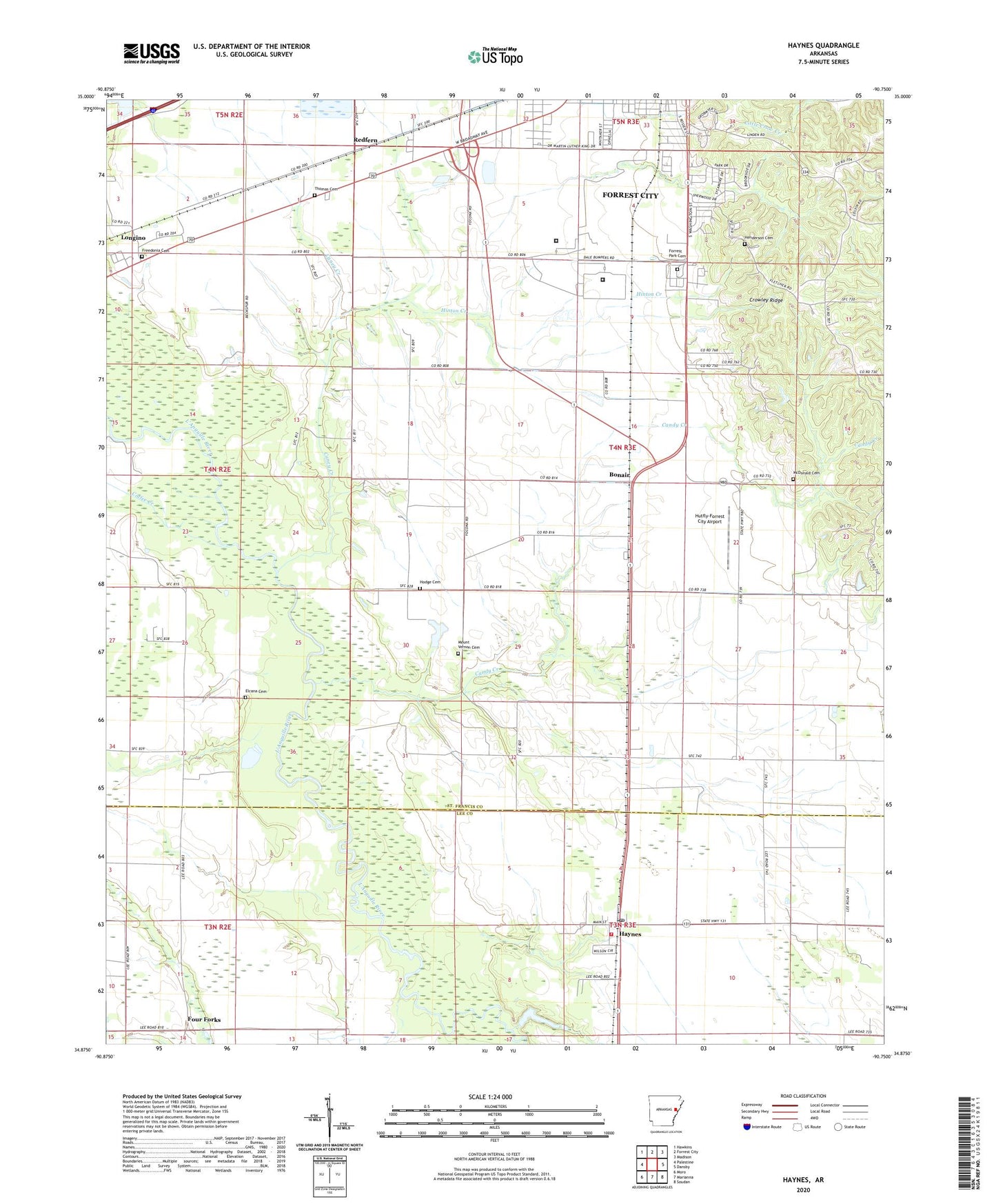
2024 topographic map quadrangle Haynes in the state of Arkansas. Scale: 1:24000. Based on the newly updated USGS 7.5' US Topo map series, this map is in the following counties: St. Francis, Lee. The map contains contour data, water features, and other items you are used to seeing on USGS maps, but also has updated roads and other features. This is the next generation of topographic maps. Printed on high-quality waterproof paper with UV fade-resistant inks.
Quads adjacent to this one:
West: Palestine
Northwest: Hawkins
North: Forrest City
Northeast: Madison
East: Dansby
Southeast: Soudan
South: Marianna
Southwest: Moro
This map covers the same area as the classic USGS quad with code o34090h7.
Contains the following named places: A W Siding, Becks, Becks Spur Baptist Church, Bonair, Bryanville, Candy Creek, Caney Creek, Coffee Creek, Elcana, Elcana Cemetery, Elcana Church, Evans Elementary School, Forrest City Federal Correctional Complex - Low Security Facility, Forrest City Federal Correctional Complex - Medium Security Facility, Forrest Park Cemetery, Four Forks, Freedonia Cemetery, Freedonia Church, Harmony Chapel, Haynes, Haynes Post Office, Haynes Rural Volunteer Fire Department, Haynes School, Henderson Cemetery, Heustess, Hinton Creek, Hodge Cemetery, Hutfly-Forrest City Airport, Jerusalem Church, KBFC-FM (Forrest City), KXJK-AM (Forrest City), Landmark Church, Longino, McDonald Cemetery, Monica, Mount Olive Church, Mount Vernon Cemetery, Mount Vernon Church, Pentecost Church, Pilgrims Rest Church, Poplar Grove, Redfern, Saint Paul Church, Shady Grove Church, Spring Grove Church, Spring Grove School, Sycamore Street Park, Thomas Cemetery, Town of Haynes, ZIP Code: 72341