MyTopo
Wheatley Arkansas US Topo Map
Couldn't load pickup availability
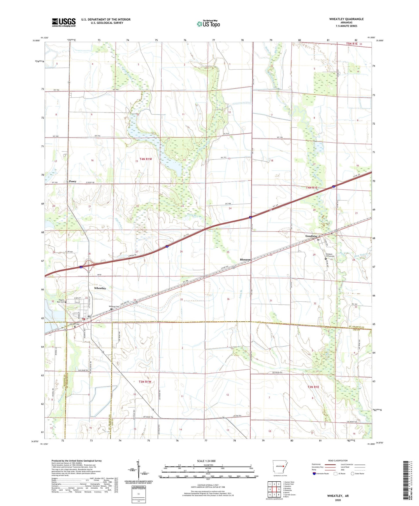
2024 topographic map quadrangle Wheatley in the state of Arkansas. Scale: 1:24000. Based on the newly updated USGS 7.5' US Topo map series, this map is in the following counties: St. Francis, Lee, Monroe. The map contains contour data, water features, and other items you are used to seeing on USGS maps, but also has updated roads and other features. This is the next generation of topographic maps. Printed on high-quality waterproof paper with UV fade-resistant inks.
Quads adjacent to this one:
West: Brinkley
Northwest: Hunter West
North: Hunter East
Northeast: Hawkins
East: Palestine
Southeast: Moro
South: Garrett Grove
Southwest: Keevil
This map covers the same area as the classic USGS quad with code o34091h1.
Contains the following named places: Blossom, City of Wheatley, East Flat Fork Creek, Goodwin, Goodwin Cemeteries, Goodwin Census Designated Place, Goodwin Post Office, Hog Tusk Creek, Johnson Cemetery, Long Branch, Monroe Academy, Mount Olive Church, Nash Corner, Palestine - Wheatley Middle School, Pilgrim Rest Cemetery, Pony Creek, Posey, Possey Church, Salem Methodist Church, Salem School, Township of Wheatley, Waldrop Cemetery, West Flat Fork Creek, Wheatley, Wheatley Elementary School, Wheatley Fire Department, Wheatley High School, Wheatley Police Department, Wheatley Post Office, ZIP Codes: 72340, 72392