MyTopo
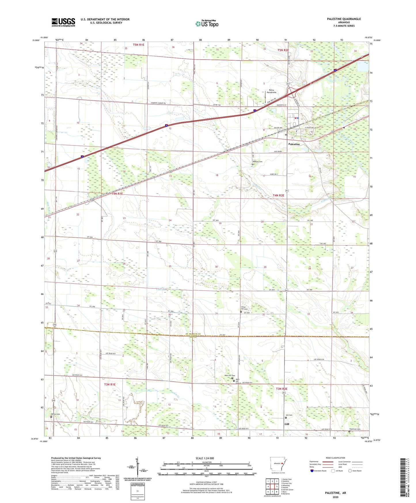
Palestine Arkansas US Topo Map
Couldn't load pickup availability
2024 topographic map quadrangle Palestine in the state of Arkansas. Scale: 1:24000. Based on the newly updated USGS 7.5' US Topo map series, this map is in the following counties: St. Francis, Lee. The map contains contour data, water features, and other items you are used to seeing on USGS maps, but also has updated roads and other features. This is the next generation of topographic maps. Printed on high-quality waterproof paper with UV fade-resistant inks.
Quads adjacent to this one:
West: Wheatley
Northwest: Hunter East
North: Hawkins
Northeast: Forrest City
East: Haynes
Southeast: Marianna
South: Moro
Southwest: Garrett Grove
This map covers the same area as the classic USGS quad with code o34090h8.
Contains the following named places: Burns Aerodrome, Calvary Bible Church, City of Palestine, Cole Lake, Gill, Gill Cemetery, Gill Community Center, Gill School, Hopewell Cemetery, Mars Hill Cemetery, Mars Hill Church, Martin Cemetery, New Salem, Palestine, Palestine - Wheatley Elementary School, Palestine - Wheatley Senior High School, Palestine Fire Station, Palestine Police Department, Palestine Post Office, Ragland Memorial Presbyterian Church, Shiloh Church, Township of Goodwin, Township of Prairie, Union Grove Church, Union Hill Cemetery, Union Hill Church, West Union Church, Westley Cemetery, ZIP Code: 72372