MyTopo
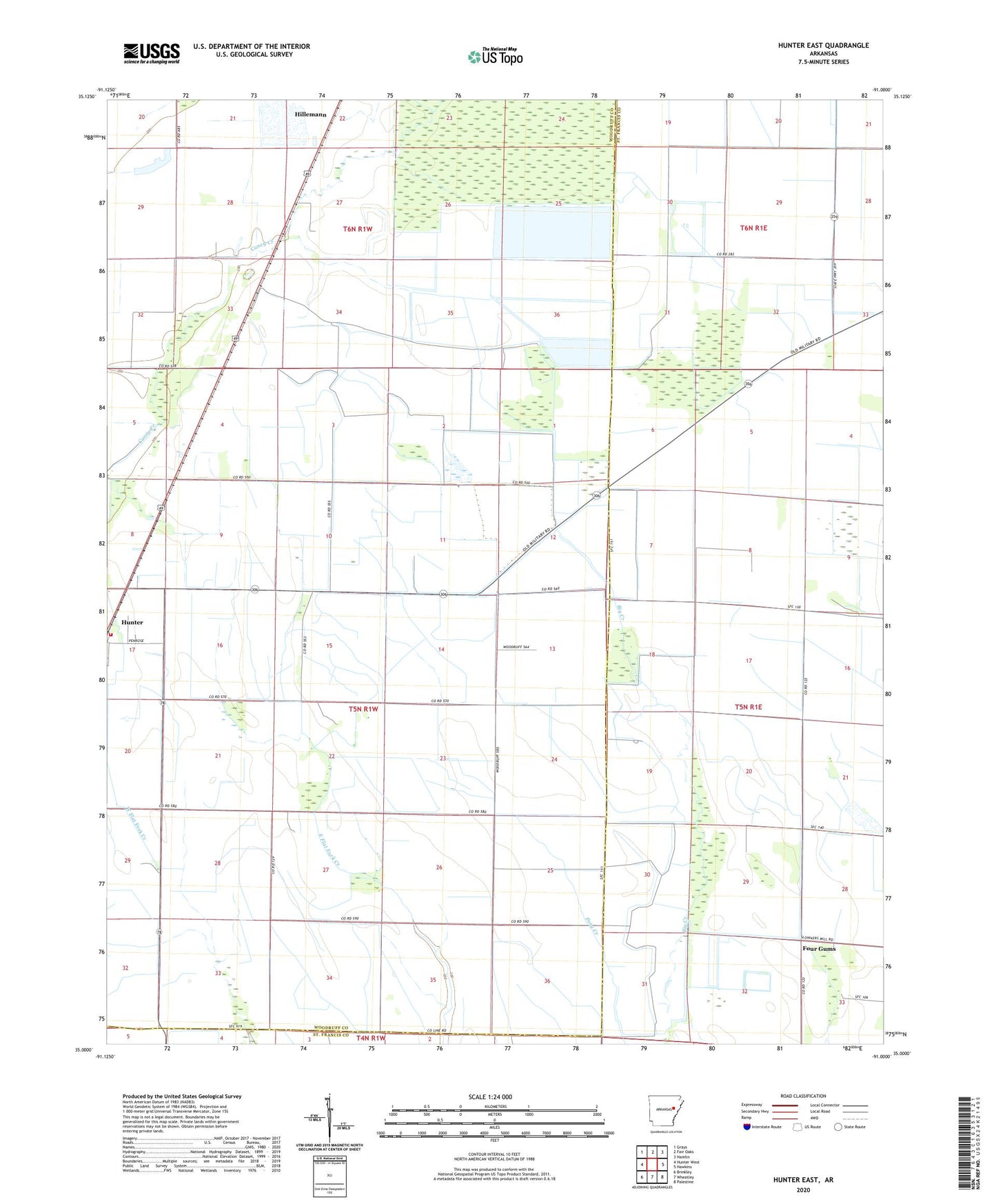
Hunter East Arkansas US Topo Map
Couldn't load pickup availability
2024 topographic map quadrangle Hunter East in the state of Arkansas. Scale: 1:24000. Based on the newly updated USGS 7.5' US Topo map series, this map is in the following counties: Woodruff, St. Francis. The map contains contour data, water features, and other items you are used to seeing on USGS maps, but also has updated roads and other features. This is the next generation of topographic maps. Printed on high-quality waterproof paper with UV fade-resistant inks.
Quads adjacent to this one:
West: Hunter West
Northwest: Grays
North: Fair Oaks
Northeast: Hamlin
East: Hawkins
Southeast: Palestine
South: Wheatley
Southwest: Brinkley
This map covers the same area as the classic USGS quad with code o35091a1.
Contains the following named places: Four Gums, Hillemann, Hunter Volunteer Fire Station, Morelock, Quinlan, Town of Hunter, Township of Caney, ZIP Code: 72074