MyTopo
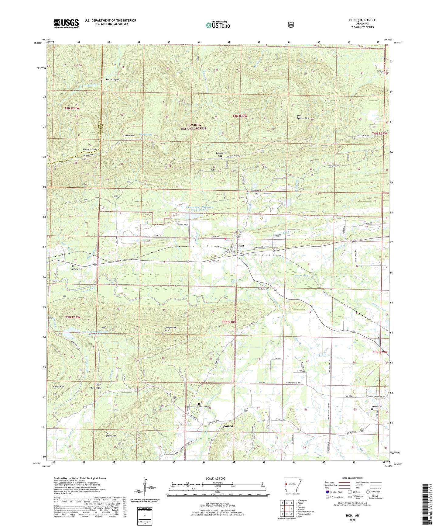
Hon Arkansas US Topo Map
Couldn't load pickup availability
Also explore the Hon Forest Service Topo of this same quad for updated USFS data
2024 topographic map quadrangle Hon in the state of Arkansas. Scale: 1:24000. Based on the newly updated USGS 7.5' US Topo map series, this map is in the following counties: Scott, Sebastian. The map contains contour data, water features, and other items you are used to seeing on USGS maps, but also has updated roads and other features. This is the next generation of topographic maps. Printed on high-quality waterproof paper with UV fade-resistant inks.
Quads adjacent to this one:
West: Cauthron
Northwest: Huntington
North: Abbott
Northeast: Ione
East: Waldron
Southeast: Boles
South: Peanut Mountain
Southwest: Horseshoe Mountain
This map covers the same area as the classic USGS quad with code o34094h2.
Contains the following named places: Anthony Cemetery, Arkansas Noname 153 Dam, Arkansas Western Landing Strip, Behorn Cemetery, Bryan, Bull Creek, Chalybeate Mountain, Cross Creek Mountain, Dobbs Spring, East Poteau Mountain, Evening Shade, Evening Shade School, Haw Creek, Haw Creek Church, Hickory Knob, Hon, Hon Branch, Hon Cemetery, Hon Volunteer Fire Department, Jones Creek, Little Cross Creek, Lookout Gap, McNally Creek, Pearson Cemetery, Phipps Branch, Pigeon Creek, Poteau River Site Seven Lake, Poteau River Watershed Site 16 Dam, Poteau River Watershed Site 16 Lake, Poteau River Watershed Site Eight Dam, Poteau River Watershed Site Eight Lake, Presley Branch, Rock Canyon, Ross Creek, Round Mountain, Russell Branch, Stewart Branch, Township of Hon, Township of Oliver, Turkey Creek, Winfield, Wolf Ridge, ZIP Code: 72958