MyTopo
Abbott Arkansas US Topo Map
Couldn't load pickup availability
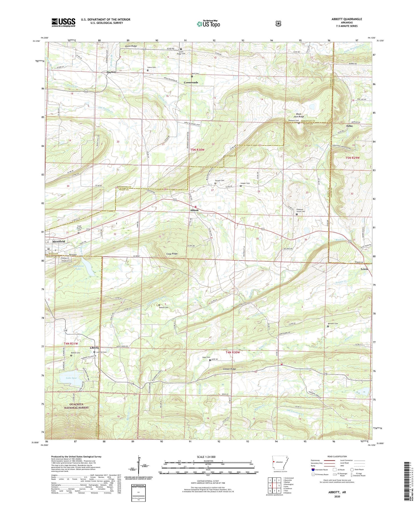
2024 topographic map quadrangle Abbott in the state of Arkansas. Scale: 1:24000. Based on the newly updated USGS 7.5' US Topo map series, this map is in the following counties: Scott, Sebastian, Logan. The map contains contour data, water features, and other items you are used to seeing on USGS maps, but also has updated roads and other features. This is the next generation of topographic maps. Printed on high-quality waterproof paper with UV fade-resistant inks.
Quads adjacent to this one:
West: Huntington
Northwest: Greenwood
North: Burnville
Northeast: Barber
East: Ione
Southeast: Waldron
South: Hon
Southwest: Cauthron
This map covers the same area as the classic USGS quad with code o35094a2.
Contains the following named places: Abbott, Bennett Cemetery, Bethel Cemetery, Black Jack Ridge, Bluff Ridge, Bull Cemetery, Calvary Church, Cantrell Cemetery, City of Mansfield, Coop Prairie Cemetery, Coop Prairie Cumberland Presbyterian Church, Coop Prairie Valley School, Coop Ridge, Cross Roads School, Crossroads, Dayton, Dickson Branch, Echo, Freedom Church, Gibson Ridge, Green Floyd Bethel Cemetery, Henry Branch, Kings Creek, Lake Spur, Lake Spur Dam, Lewis, Lewis Cemetery, Liberty, Little Petit Jean Creek, Looper Cemetery, Mansfield Dam, Mansfield Elementary School, Mansfield Gas Field, Mansfield High School, Mansfield Lake, Mansfield Middle School, Mansfield Post Office, Northwest Scott County Volunteer Fire Department Station 1, Northwest Scott County Volunteer Fire Department Station 2, Orten Creek, Pine Grove Valley, Pinkston Cemetery, Pleasant Grove Cemetery, Pleasant Grove Number 3 Baptist Church, Rock Creek Church, Slate Cemetery, Sorrels Cemetery, Township of Dayton, Township of Lewis, Union Ridge, Union Ridge Cemetery, ZIP Code: 72944