MyTopo
Ione Arkansas US Topo Map
Couldn't load pickup availability
Also explore the Ione Forest Service Topo of this same quad for updated USFS data
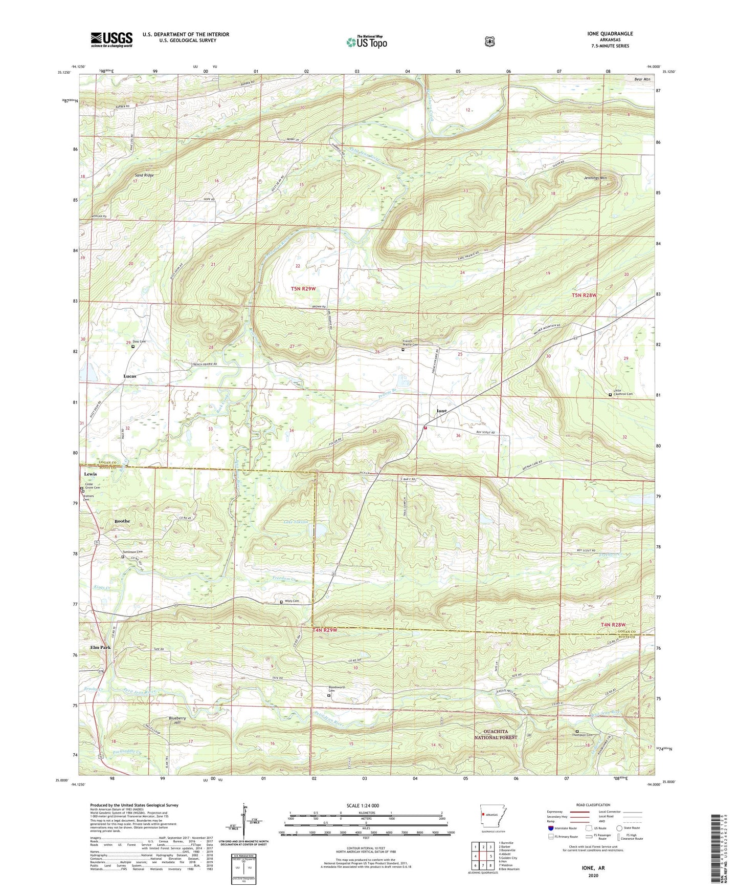
2024 topographic map quadrangle Ione in the state of Arkansas. Scale: 1:24000. Based on the newly updated USGS 7.5' US Topo map series, this map is in the following counties: Logan, Scott. The map contains contour data, water features, and other items you are used to seeing on USGS maps, but also has updated roads and other features. This is the next generation of topographic maps. Printed on high-quality waterproof paper with UV fade-resistant inks.
Quads adjacent to this one:
West: Abbott
Northwest: Burnville
North: Barber
Northeast: Booneville
East: Golden City
Southeast: Bee Mountain
South: Waldron
Southwest: Hon
This map covers the same area as the classic USGS quad with code o35094a1.
Contains the following named places: Arkansas Department of Corrections Prison Farm, B J F Trotter Heirs Private Cemetery, Bloodsworth Cemetery, Blueberry Hill, Boothe, Brushy Creek, Cahinnio Camp, Cedar Creek, Cedar Grove Cemetery, Doss Cemetery, Earl Prairie District School Number 66, Elm Park, Freedom Creek, French Prairie Cemetery, Ione, Ione Baptist Church, Ione Volunteer Fire Department, Jennings Mountain, Kings Creek, Lake Lakima Dam, Lake Takima, Little Cauthron Cemetery, Lucas, Lucas Cumberland Presbyterian Church, Mount View Church, Old Freedom Creek, Packsaddle Creek, Pilot View Church, Pine Log Church, Prairie Branch, Prairie Creek, Rock Creek, Rogers Camp, Sand Ridge, Thompson Cemetery, Tomlinson Cemetery, Township of Barber, Township of Tomlinson, Washburn Creek, Wiley Cemetery, Worth James Ranch Airport