MyTopo
Cauthron Arkansas US Topo Map
Couldn't load pickup availability
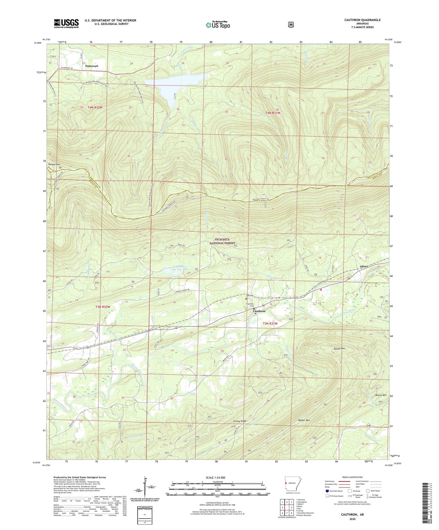
2024 topographic map quadrangle Cauthron in the state of Arkansas. Scale: 1:24000. Based on the newly updated USGS 7.5' US Topo map series, this map is in the following counties: Scott, Sebastian. The map contains contour data, water features, and other items you are used to seeing on USGS maps, but also has updated roads and other features. This is the next generation of topographic maps. Printed on high-quality waterproof paper with UV fade-resistant inks.
Quads adjacent to this one:
West: Bates
Northwest: Hartford
North: Huntington
Northeast: Abbott
East: Hon
Southeast: Peanut Mountain
South: Horseshoe Mountain
Southwest: Loving
This map covers the same area as the classic USGS quad with code o34094h3.
Contains the following named places: Alum Fork, Cauthron, Cauthron Cemetery, Cauthron Post Office, Cross Creek, Gum Branch, Jerico Branch, Kirk Cemetery, Morgan Spring Church, Morgan Springs, Oliver, Patterson, Posey Creek, Poteau Lookout Tower, Poteau Mountain, Poteau Mountain Wilderness, Poteau River Site Nine Lake, Poteau River Watershed Site Nine Dam, Robertson Branch, Round Mountain, Sixmile Creek, State Line Cauthron Volunteer Fire Department, Township of Cauthron, Twomile Creek, Walker Mountain, Widow Creek