MyTopo
Round Pond Arkansas US Topo Map
Couldn't load pickup availability
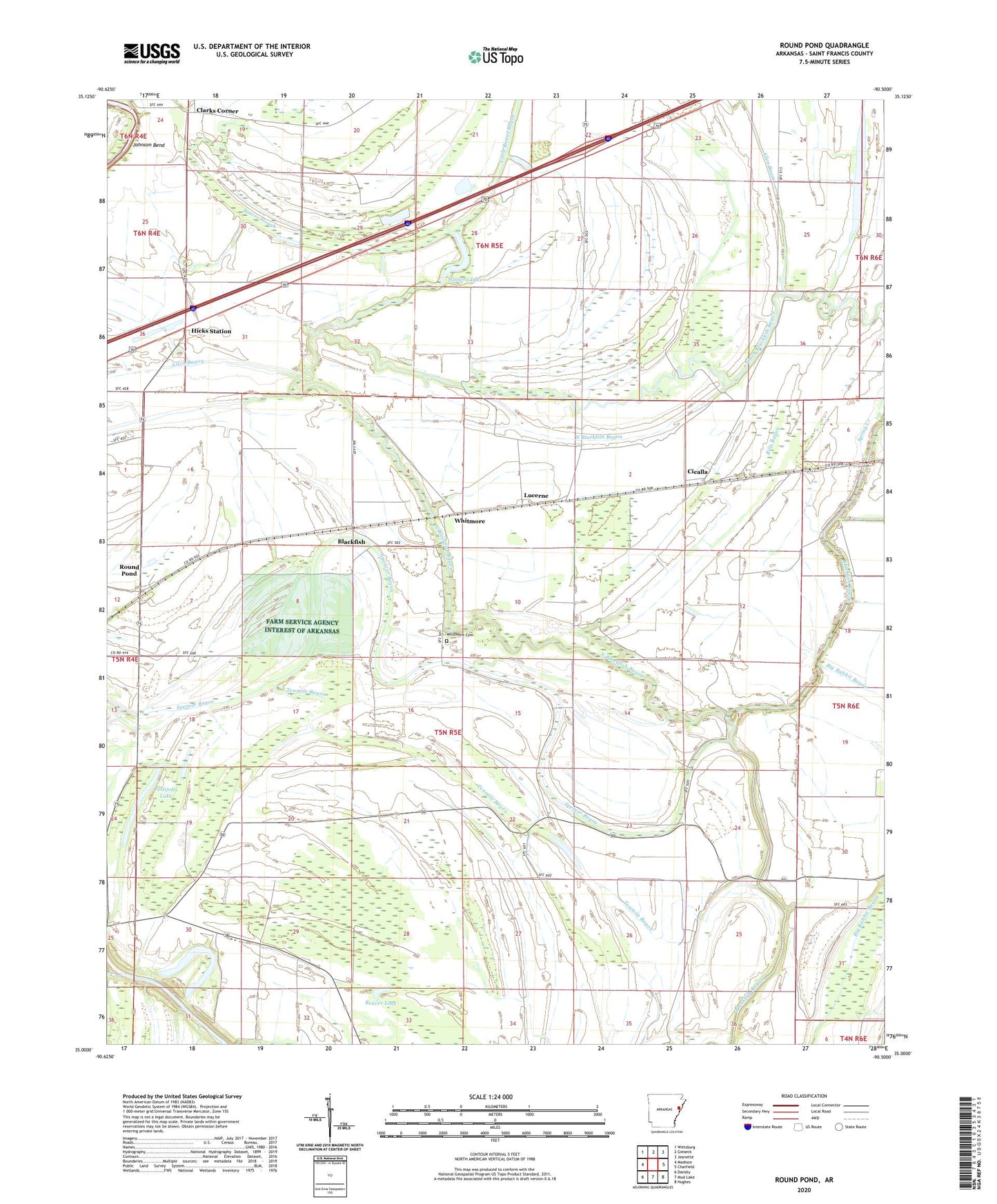
2024 topographic map quadrangle Round Pond in the state of Arkansas. Scale: 1:24000. Based on the newly updated USGS 7.5' US Topo map series, this map is in the following counties: St. Francis. The map contains contour data, water features, and other items you are used to seeing on USGS maps, but also has updated roads and other features. This is the next generation of topographic maps. Printed on high-quality waterproof paper with UV fade-resistant inks.
Quads adjacent to this one:
West: Madison
Northwest: Wittsburg
North: Gieseck
Northeast: Jeanette
East: Chatfield
Southeast: Hughes
South: Mud Lake
Southwest: Dansby
This map covers the same area as the classic USGS quad with code o35090a5.
Contains the following named places: Allen Bayou, Beaver Lake, Beaver Slough, Bethlehem Church, Bills Bayou, Blackfish, Blackfish School, Burnt Cane Church, Cicalla, Clarks Corner, Dillon Ferry, Ditch Number 26, Farm Service Agency Interest of Arkansas, Hicks Station, Hillclark School, Islam Church, Johnson Bend, Little Bivens Bayou, Lucerne, Macedonia Church, Macedonia School, New Home, New Home Church, New Home School, Nichols Lake, North Blackfish Bayou, Pettijohn Lake, Pilgrim Rest Church, Round Pond, Round Pond Methodist Church, Round Pond Post Office, Rush Lake, Shiloh Church, Spencer Bayou, Spring Creek, Tenmile Bayou, Township of Griggs, Whitmore, Whitmore Cemetery, Wiggins Lake, ZIP Code: 72394