MyTopo
Imboden Arkansas US Topo Map
Couldn't load pickup availability
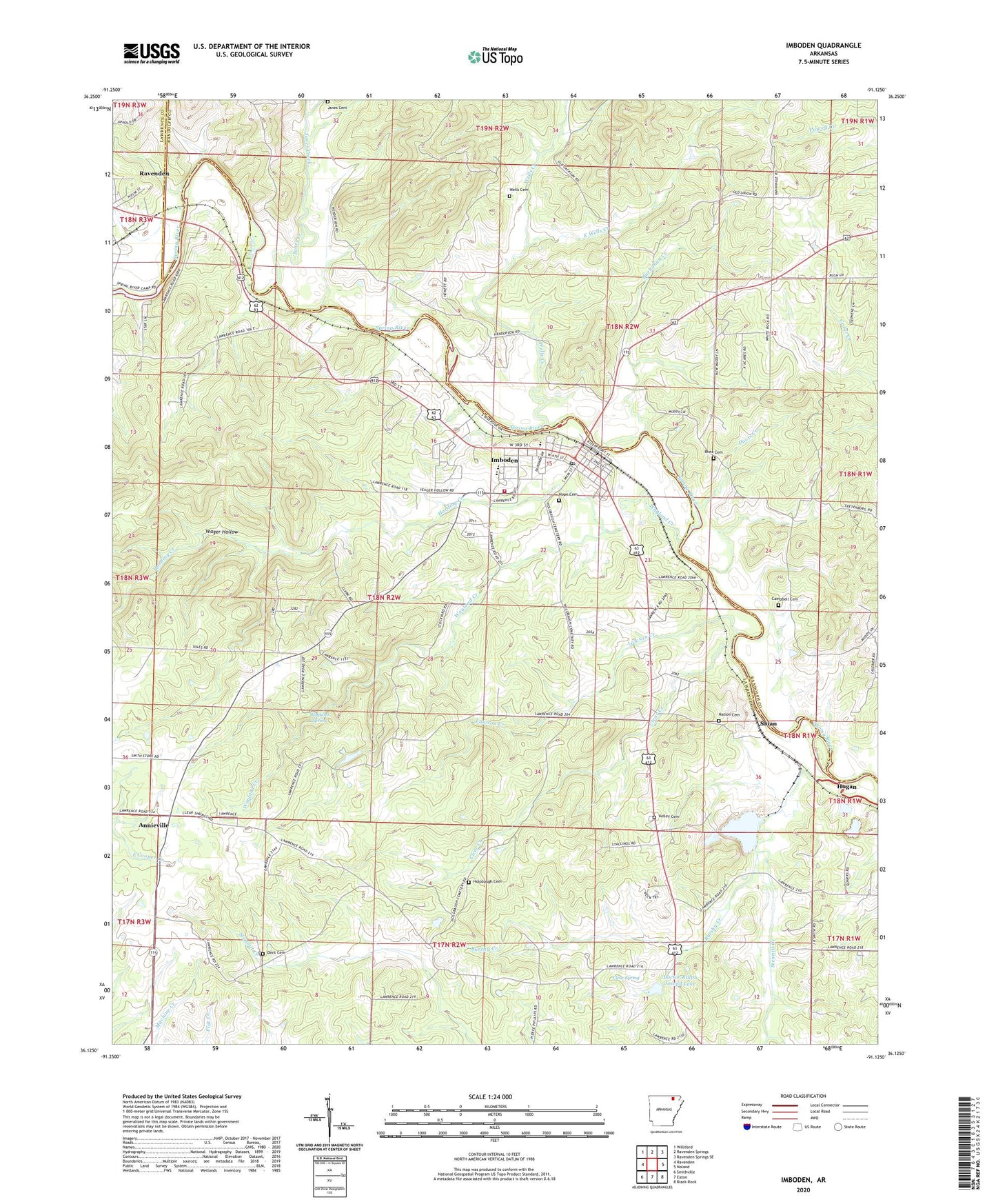
2024 topographic map quadrangle Imboden in the state of Arkansas. Scale: 1:24000. Based on the newly updated USGS 7.5' US Topo map series, this map is in the following counties: Lawrence, Randolph. The map contains contour data, water features, and other items you are used to seeing on USGS maps, but also has updated roads and other features. This is the next generation of topographic maps. Printed on high-quality waterproof paper with UV fade-resistant inks.
Quads adjacent to this one:
West: Ravenden
Northwest: Williford
North: Ravenden Springs
Northeast: Ravenden Springs SE
East: Noland
Southeast: Black Rock
South: Eaton
Southwest: Smithville
This map covers the same area as the classic USGS quad with code o36091b2.
Contains the following named places: Annieville, Black Rock Quarry, Buchanan Creek, Burshy Creek, Campbell Cemetery, Clear Creek, Clear Spring, Clear Spring Church, Davis Creek, Dent Cemetery, Doctor Ralph Joseph Lake, Doctor Ralph Joseph Lake Dam, East Wells Creek, Harding Creek, Hogan, Holobaugh Cemetery, Hope Cemetery, Imboden, Imboden Area Charter School, Imboden Lookout Tower, Imboden Post Office, Imboden Volunteer Fire Station, Janes Cemetery, Janes Creek, Kelley Cemetery, Lawson Creek, Nation Cemetery, Pleasant Grove Church, Rhea Cemetery, Sloan, Sloan - Hendrix Elementary School, Sloan - Hendrix High School, Starling Creek, Stennitt Creek, Town of Imboden, Township of Annieville, Township of Dent, Township of Spring River, Valley Stone, Wayland Creek, Wayland Spring, Wayland Spring Camp, Wells Cemetery, Wells Creek, Yeager Hollow, ZIP Codes: 72415, 72434