MyTopo
Black Rock Arkansas US Topo Map
Couldn't load pickup availability
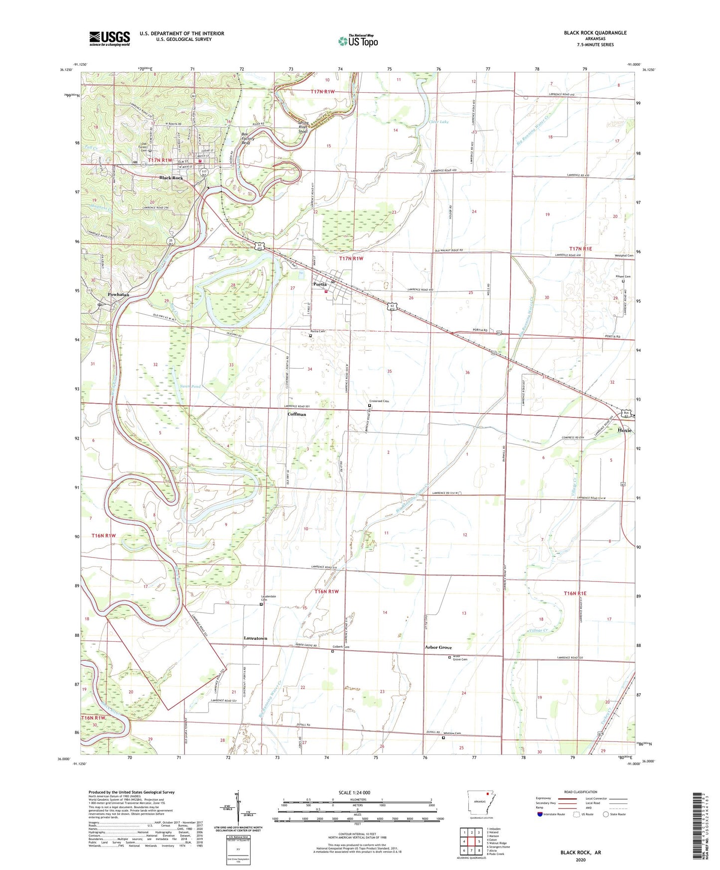
2024 topographic map quadrangle Black Rock in the state of Arkansas. Scale: 1:24000. Based on the newly updated USGS 7.5' US Topo map series, this map is in the following counties: Lawrence, Randolph. The map contains contour data, water features, and other items you are used to seeing on USGS maps, but also has updated roads and other features. This is the next generation of topographic maps. Printed on high-quality waterproof paper with UV fade-resistant inks.
Quads adjacent to this one:
West: Eaton
Northwest: Imboden
North: Noland
Northeast: Manson
East: Walnut Ridge
Southeast: Podo Creek
South: Alicia
Southwest: Strangers Home
This map covers the same area as the classic USGS quad with code o36091a1.
Contains the following named places: Arbor Grove, Arbor Grove Cemetery, Arbor Grove Church, Bay Creek, Black Rock, Black Rock Elementary School, Black Rock High School, Black Rock Police Department, Black Rock Post Office, Black Rock Volunteer Fire Department, Box Factory Bend, City of Black Rock, Clear Lake, Clear Lake Church, Clear Lake School, Coffman, Coffman School, Colberk Cemetery, Crossroad Cemetery, Eagle Riffle, Fall Creek, Horner Bay, Kissee Cemetery, Lauderdale Cemetery, Lauderdale Church, Lauderdale School, Lauratown, Lawrence County, Magness Creek, Oak Forest Cemetery, Portia, Portia Bay, Portia Cemetery, Portia Post Office, Portia School, Portia Volunteer Fire Department, Powhatan, Powhatan Courthouse, Powhatan Historic State Park, Powhatan Jail, Powhatan Male and Female Academy, Powhatan Post Office, Recker Landing Field, Spring River, Spring River Shoal, Swan Pond, Telephone Exchange Building, Town of Portia, Town of Powhatan, Township of Duty, Whitlow Cemetery, ZIP Codes: 72433, 72457