MyTopo
Eaton Arkansas US Topo Map
Couldn't load pickup availability
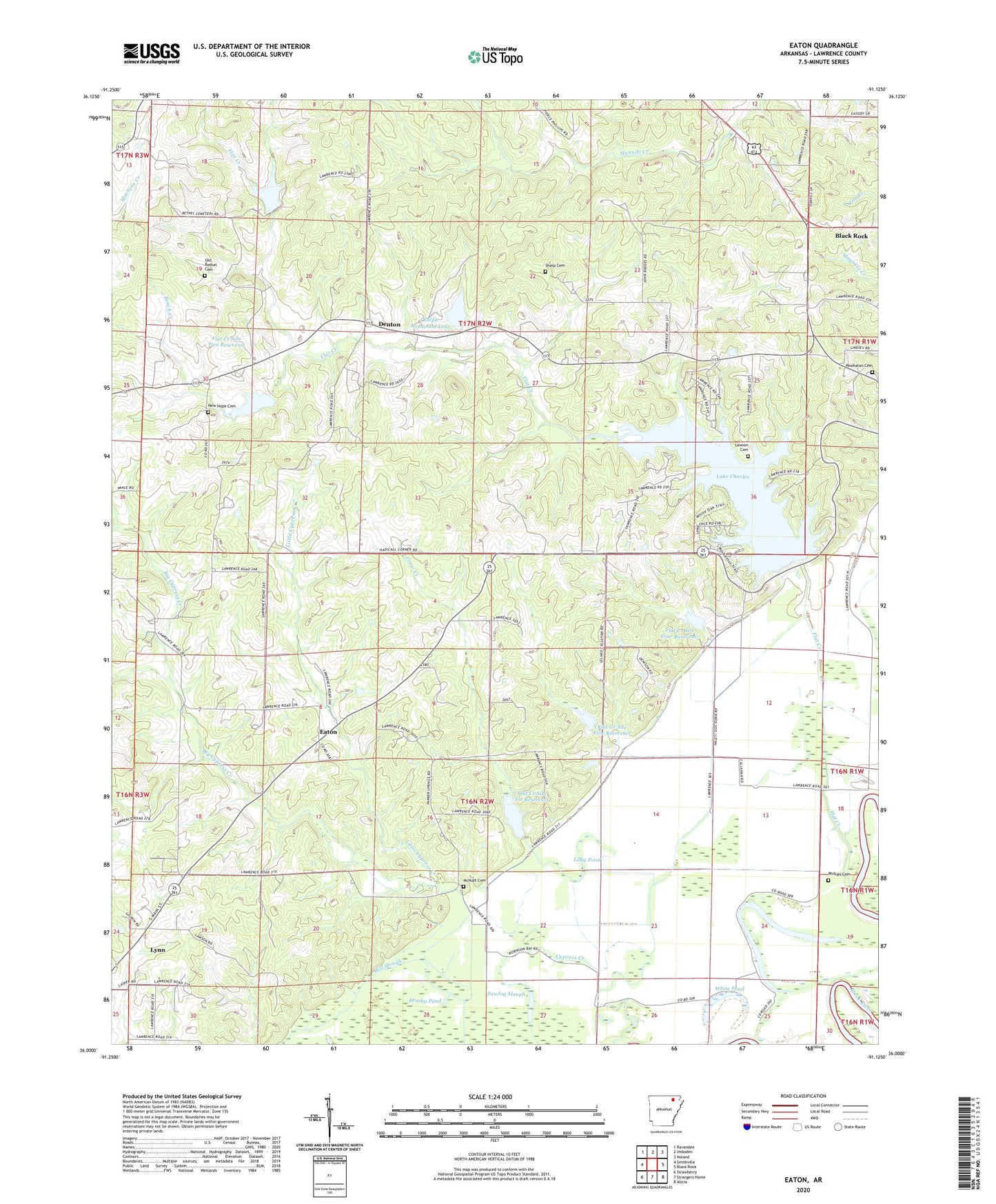
2024 topographic map quadrangle Eaton in the state of Arkansas. Scale: 1:24000. Based on the newly updated USGS 7.5' US Topo map series, this map is in the following counties: Lawrence. The map contains contour data, water features, and other items you are used to seeing on USGS maps, but also has updated roads and other features. This is the next generation of topographic maps. Printed on high-quality waterproof paper with UV fade-resistant inks.
Quads adjacent to this one:
West: Smithville
Northwest: Ravenden
North: Imboden
Northeast: Noland
East: Black Rock
Southeast: Alicia
South: Strangers Home
Southwest: Strawberry
This map covers the same area as the classic USGS quad with code o36091a2.
Contains the following named places: Bench Creek, Big Cypress Creek, Brushy Pond, Cedar Grove Church, Crow Creek, Denton, Eaton, Fish Pond, Flat Creek, Flat Creek Site Five Dam, Flat Creek Site Five Reservoir, Flat Creek Site Four Dam, Flat Creek Site Four Reservoir, Flat Creek Site One Dam, Flat Creek Site Six Dam, Flat Creek Site Six Reservoir, Flat Creek Site Three Dam, Flat Creek Site Two Dam, Flat Creek Site Two Reservoir, Lake Charles, Lake Charles State Park, Lawson Cemetery, Lebanon Church, Little Cypress Creek, Long Pond, McNutt Cemetery, New Hope Cemetery, New Hope Church, Oak Grove Church, Oak Ridge School, Old Bethel Cemetery, Phillips Cemetery, Phillips Lake, Powhatan Cemetery, Ralph McDonald Lake, Ralph McDonald Lake Dam, Robinson Bay, Sawlog Slough, Sharp Cemetery, Shirey Bay-Rainey Brake State Game Manag, Township of Black River, Township of Black Rock, Township of Eaton, Township of Flat Creek, White Pond, ZIP Codes: 72440, 72458