
MyTopo
Montgomery Island Arkansas US Topo Map
Couldn't load pickup availability
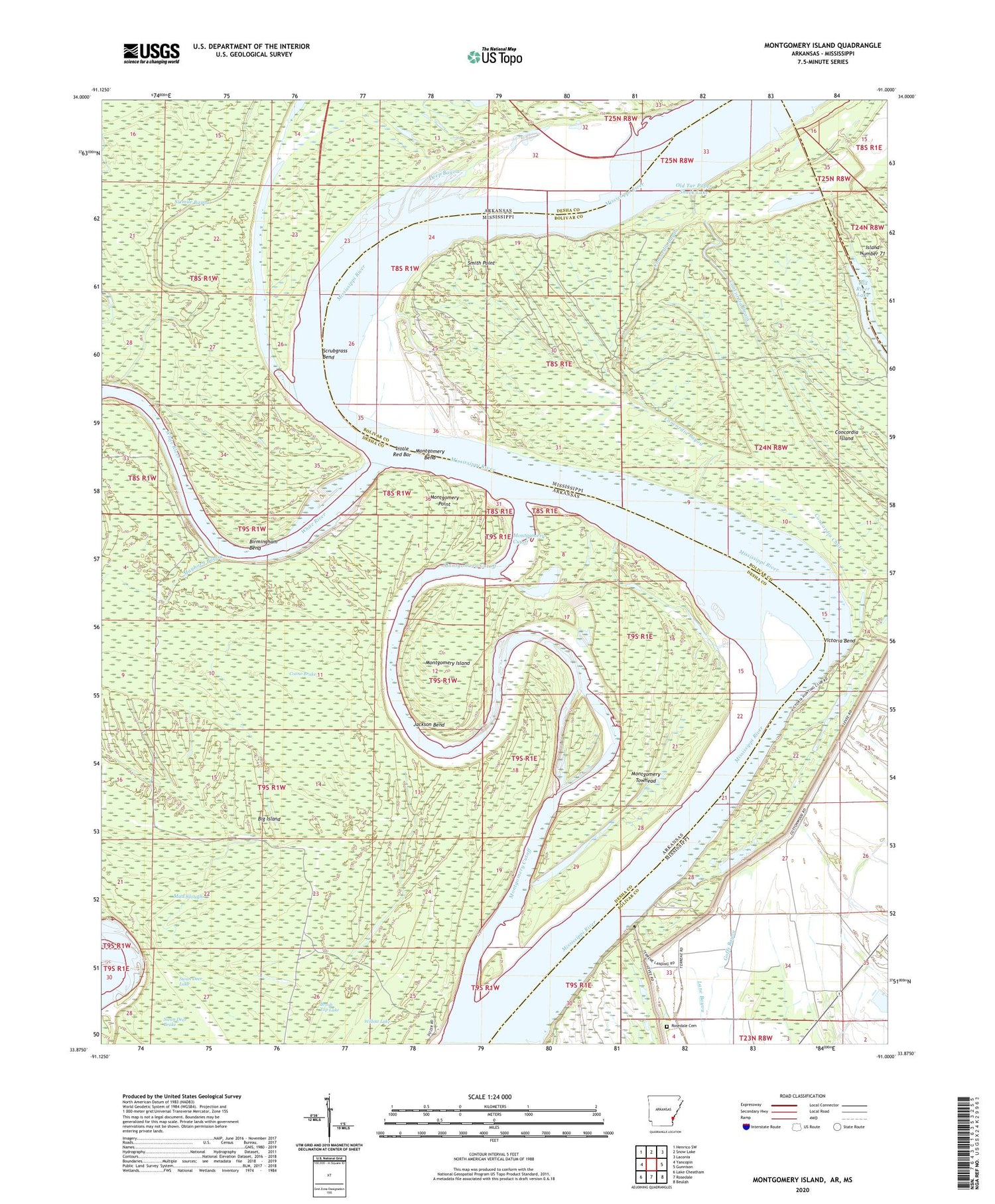
2024 topographic map quadrangle Montgomery Island in the states of Arkansas, Mississippi. Scale: 1:24000. Based on the newly updated USGS 7.5' US Topo map series, this map is in the following counties: Desha, Bolivar. The map contains contour data, water features, and other items you are used to seeing on USGS maps, but also has updated roads and other features. This is the next generation of topographic maps. Printed on high-quality waterproof paper with UV fade-resistant inks.
Quads adjacent to this one:
West: Yancopin
Northwest: Henrico SW
North: Snow Lake
Northeast: Laconia
East: Gunnison
Southeast: Beulah
South: Rosedale
Southwest: Lake Cheatham
Contains the following named places: Big Island, Big Island Revetment, Birmingham Bend, Brush Top Lake, Concordia Bayou, Concordia Bend, Concordia Chute, Concordia Drain, Concordia Island, Coono Brake, Henrico Dikes, Jackson Bend, Lane Landing, Little Red Bar, Mayhorn Bayou, McClellan Lake, Montgomery Bend, Montgomery Cutoff, Montgomery Island, Montgomery Point, Montgomery Towhead, Montgomery Towhead Dikes, Mud Slough, Old Tar Paper Shack Lake, Old White River, Rose Landing, Rosedale Cemetery, Saint Pauls Church, Scrubgrass Bend, Scrubgrass Bend Revetment, Sixmile Bayou, Smith Point, Terrene Landing, Victoria Bend, White River, White River Landing, White River Landing Dikes, Willow Lake, ZIP Code: 72328


