MyTopo
Snow Lake Arkansas US Topo Map
Couldn't load pickup availability
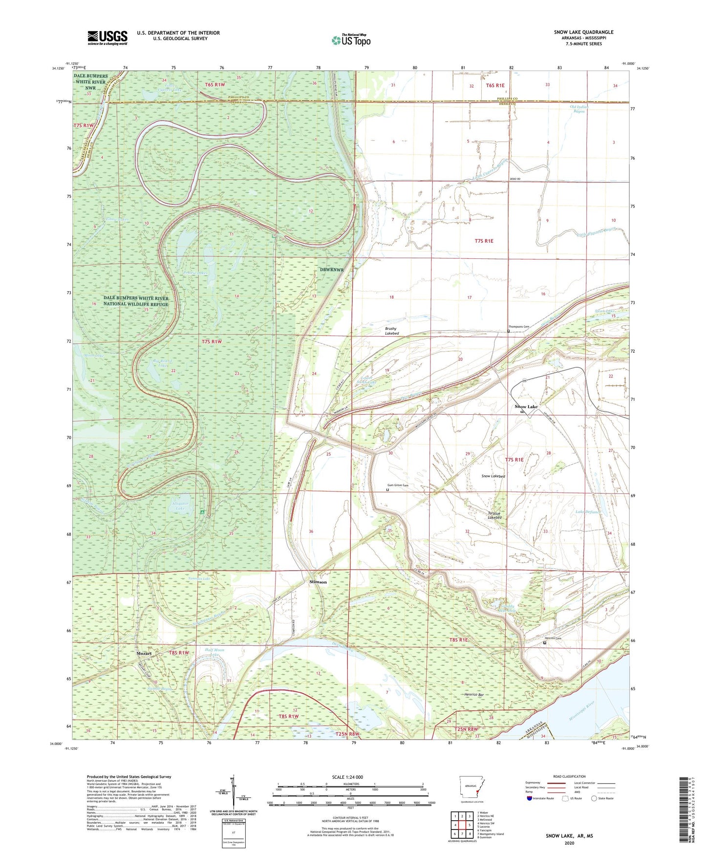
2024 topographic map quadrangle Snow Lake in the state of Arkansas. Scale: 1:24000. Based on the newly updated USGS 7.5' US Topo map series, this map is in the following counties: Desha, Phillips, Arkansas, Bolivar. The map contains contour data, water features, and other items you are used to seeing on USGS maps, but also has updated roads and other features. This is the next generation of topographic maps. Printed on high-quality waterproof paper with UV fade-resistant inks.
Quads adjacent to this one:
West: Henrico SW
Northwest: Weber
North: Henrico NE
Northeast: Mellwood
East: Laconia
Southeast: Gunnison
South: Montgomery Island
Southwest: Yancopin
Contains the following named places: Alligator Lake, Bear Lake, Big Round Lake, Brushy Lakebed, Deep Bayou, Elbow Lakes, Graddy Blue Hole, Gum Grove Cemetery, Half Moon Lake, Henrico, Henrico Bar, Henrico Cemetery, Laconia Circle, Laconia Circle Levee, Lake Defiance, Little Cypress Bayou, Little Cypress Lake, Lower Swan Lake, Lower Taylor Lake, Moon Lake, Mount Olive Church, Mozart, New Canaan Church, New Cane School, Old Indian Bayou, Prairie Lakes, Scrubgrass Campground, Sixmile Bayou, Snow Lake, Snow Lake Baptist Church, Snow Lake Post Office, Snow Lakebed, Stimson, Swan Lake, Tarblue Lake, Tarblue Lakebed, Thompsons Cemetery, Township of Mississippi, Yancopin Lake, ZIP Code: 72379