MyTopo
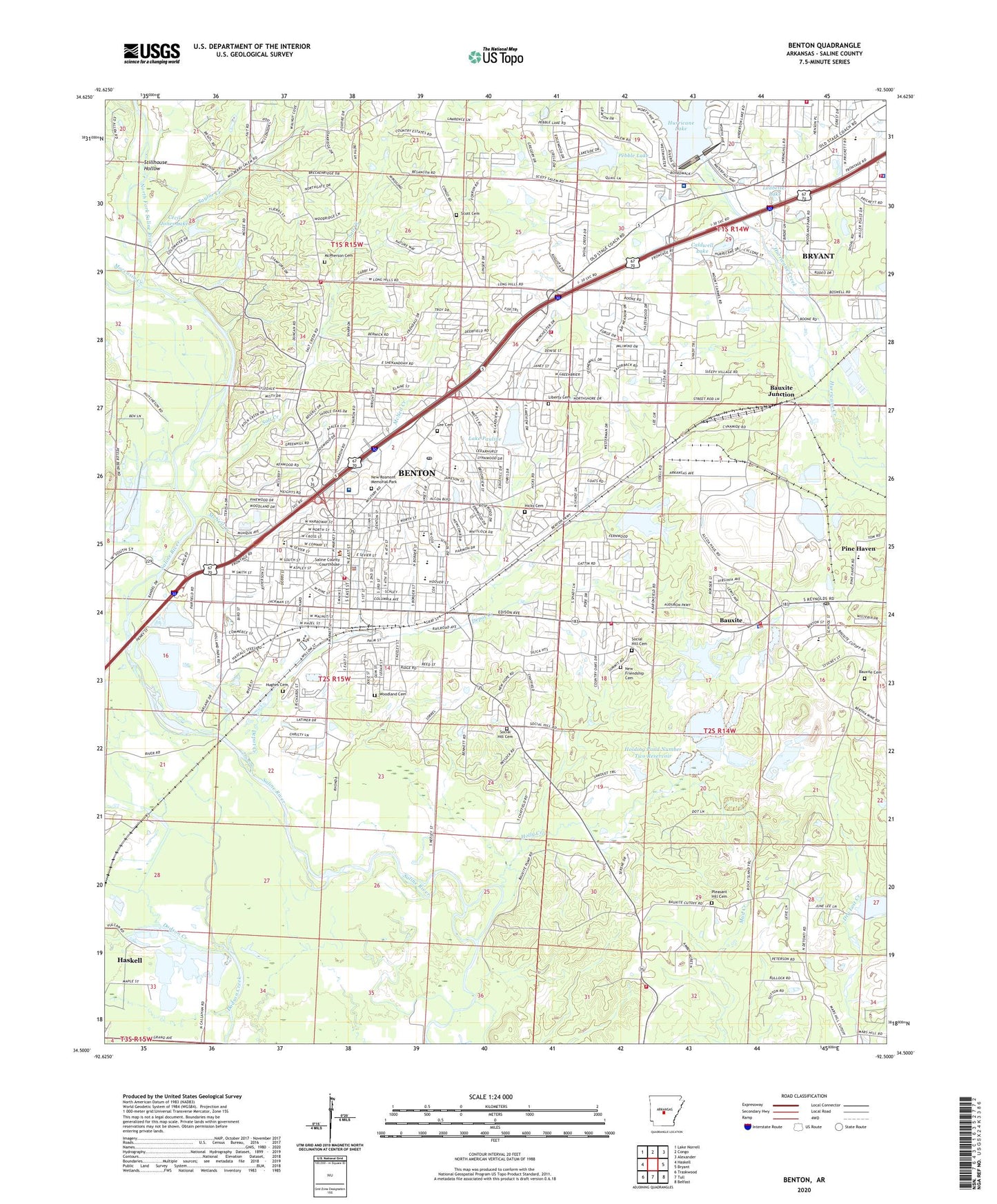
Benton Arkansas US Topo Map
Couldn't load pickup availability
2024 topographic map quadrangle Benton in the state of Arkansas. Scale: 1:24000. Based on the newly updated USGS 7.5' US Topo map series, this map is in the following counties: Saline. The map contains contour data, water features, and other items you are used to seeing on USGS maps, but also has updated roads and other features. This is the next generation of topographic maps. Printed on high-quality waterproof paper with UV fade-resistant inks.
Quads adjacent to this one:
West: Haskell
Northwest: Lake Norrell
North: Congo
Northeast: Alexander
East: Bryant
Southeast: Belfast
South: Tull
Southwest: Traskwood
This map covers the same area as the classic USGS quad with code o34092e5.
Contains the following named places: Alcoa Water Supply, Alum Fork Saline River, Angie Grant Elementary School, Bauxite, Bauxite Cemetery, Bauxite Fire Department, Bauxite High School, Bauxite Junction, Bauxite Police Department, Bauxite Post Office, Bauxite Volunteer Fire Station 2, Bennett School, Benton, Benton City Hall, Benton Fire Department Station 1 - Central Station and Administrative Offices, Benton Fire Department Station 2 - Curtis Fire Station, Benton Fire Department Station 3 - Ragan Fire Station, Benton Fire Department Station 4, Benton High School, Benton Junior High School, Benton Middle School, Benton Police Department, Benton Post Office, Benton Square Shopping Center, Bernard W Holland Park, Bethel Missionary Baptist Church, Bryant Fire and Rescue Station 3, Caldwell Elementary School, Caldwell Lake, Caldwell Lake Dam, Calvary Baptist Church, Cecil Jones Lake, Cecil Jones Lake Dam, Chemical Products Fresh Water Lake Dam, City of Benton, Civitan School, Collegeville Elementary School, Depot Creek, Dotted Lake, East Side Baptist Church, East Side Junior High School, Edgewood, Ferguson Plaza Shopping Center, First Assembly of God Church, First Baptist Church, First Church of the Nazarene, First Lutheran Church, First Pentecostal Church, First Presbyterian Church, First United Methodist Church, Fletcher-Hudspeth-Harris Mine, Forest Hills Missionary Baptist Church, Foursquare Evangelical Church, Gann Museum, Gibbons, Globe 28 Mine, Hicks Cemetery, Highland Heights Baptist Church, Holding Pond Number 2 Dam, Holding Pond Number Two Reservoir, Holly Creek, Howard Perrin Elementary School, Hughes Cemetery, Hurricane Lake, Hurricane Lake Church, Hurricane Lake Dam, KAKI-FM (Benton), KBBA-AM (Benton), KGKO-AM (Benton), Lake Pauline, Ledbetter Lake, Ledbetter Lake Dam, Lee Cemetery, Lena, Lewis Stadium, Liberty Memorial Cemetery, Lincoln Square Shopping Center, Lone Seventh Mine, Longhills Golf Course, Lyle Park, Maggie Mine, Mauldin Fire Station, McNeil Creek, McPherson Cemetery, Military Plaza Shopping Center, Moccasin Creek, Mount Carmel Methodist Church, Mount Vernon Baptist Church, Mount Zion Missionary Baptist Church, Mulberry Church, Mulberry School, New Friendship Cemetery, New Hope United Methodist Church, New Rosmont Memorial Park, New Summit Church, Niloak Shopping Center, North Fork Saline River, Notre Dame School, Our Lady of Fatima Catholic Church, Ozark 28 Mine, Parkview United Methodist Church, Pebble Lake, Pebble Lake Dam, Perrin Elementary School, Pine Haven Elementary School, Pleasant Hill African Methodist Episcopal Church, Pleasant Hill Cemetery, Poodle Mine, Pruden Extension Mine, Pruden Mine, Ramsey Mine, Richardson Place, Ridgecrest Baptist Church, Ringgold Elementary School, Rivendell Behavioral Health Services, Saine County Fairgrounds, Saint Matthews Episcopal Church, Salem Elementary School, Salem Methodist Church, Saline County Courthouse, Saline County Detention Center, Saline County Public Library, Saline Memorial Hospital, Saline Memorial Hospital Heliport, Salt Creek, Scott Cemetery, Section 16 Mine, Section 17 Mine, Section 28 Mine, Sharon Missionary Baptist Church, Shaw School, Shaw Volunteer Fire Department, Sherwood Estates, Siddell School, Silica Heights Church, Smith Mine, Social Hill Cemetery, Social Hill Missionary Baptist Church, Southern Acid and Sulphur Mine, Spring Creek Missionary Baptist Church, Spring Hill Mine, Springhill Volunteer Fire Department, Standard Mine, Stillhouse Hollow, Stuckey Mine, Taylor Creek, Timber Lake, Township of Bauxite, Township of Haskell, Township of Saline, Trinity Baptist Church, Tyndall Park, United Missionary Baptist Church, West Bauxite Missionary Baptist Church, West Side School, Whitlock, Woodland, Woodland Cemetery, Wright Chapel, Young Mine


