MyTopo
Haskell Arkansas US Topo Map
Couldn't load pickup availability
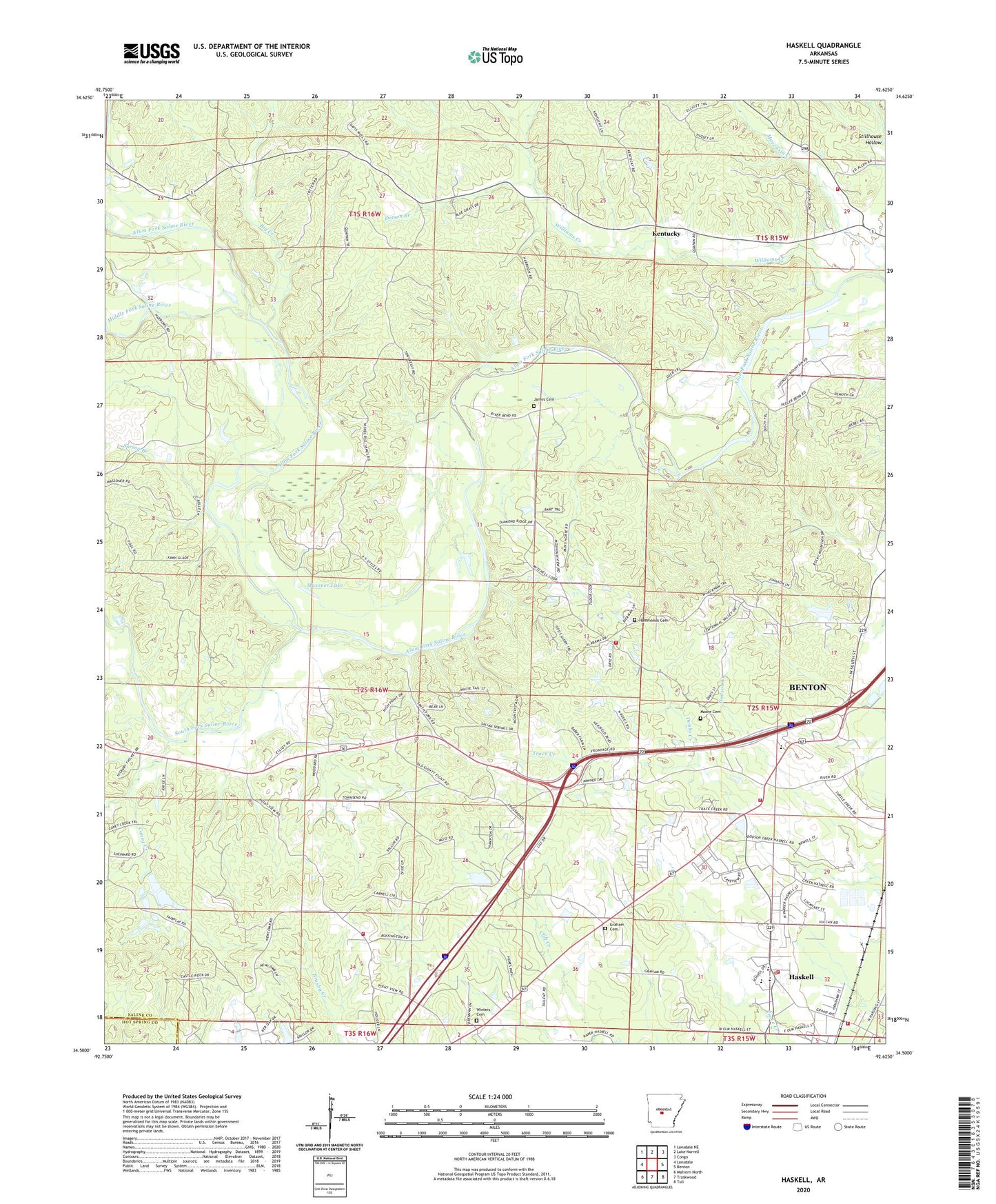
2024 topographic map quadrangle Haskell in the state of Arkansas. Scale: 1:24000. Based on the newly updated USGS 7.5' US Topo map series, this map is in the following counties: Saline, Hot Spring. The map contains contour data, water features, and other items you are used to seeing on USGS maps, but also has updated roads and other features. This is the next generation of topographic maps. Printed on high-quality waterproof paper with UV fade-resistant inks.
Quads adjacent to this one:
West: Lonsdale
Northwest: Lonsdale NE
North: Lake Norrell
Northeast: Congo
East: Benton
Southeast: Tull
South: Traskwood
Southwest: Malvern North
This map covers the same area as the classic USGS quad with code o34092e6.
Contains the following named places: Alum, Benton State Hospital, Big Creek, Buffington Lake, Buffington Lake Dam, Camp Quapaw, Caney Creek, City of Haskell, Cross Roads Church, Daniels Ford, Dobbs Creek, Dotson Branch, Emmanuel Church, Fairplay, Graham Cemetery, Hammonds Cemetery, Harmony Grove High School, Harmony Grove Middle School, Haskell, Haskell Fire Department, Haskell Fire Department Station 1, Haskell Police Department, James Cemetery, Kentucky, Kentucky Church, Kentucky School, Klondike, Masoner Lake, Middle Fork Saline River, Moore Cemetery, Mount Harmony Missionary Baptist Church, Mountain View Church, Mountain View School, Nelson Ford, New Prospect Missionary Baptist Church, Prospect School, Salem Fire Department Station 4, Slocomb, Smith Ford, South Fork Saline River, Spring Branch, Tenmile Creek, Township of Fairplay, Township of Kentucky, Township of Newcomb, Trace Creek Country Club, Turtle Creek Fire and Rescue, Turtle Creek Volunteer Fire Department Station 2, Turtle Creek Volunteer Fire Department Station 3, Viewpoint School, Westbrook Elementary School, Will James Ford, Williams Creek, Winters Cemetery, Wise Lake, Wise Lake Dam