MyTopo
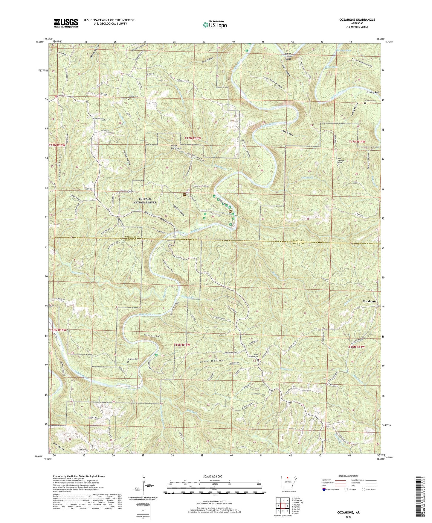
Cozahome Arkansas US Topo Map
Couldn't load pickup availability
2024 topographic map quadrangle Cozahome in the state of Arkansas. Scale: 1:24000. Based on the newly updated USGS 7.5' US Topo map series, this map is in the following counties: Searcy, Marion. The map contains contour data, water features, and other items you are used to seeing on USGS maps, but also has updated roads and other features. This is the next generation of topographic maps. Printed on high-quality waterproof paper with UV fade-resistant inks.
Quads adjacent to this one:
West: Maumee
Northwest: Yellville
North: Rea Valley
Northeast: Buffalo City
East: Big Flat
Southeast: Landis
South: Harriet
Southwest: Marshall
This map covers the same area as the classic USGS quad with code o36092a5.
Contains the following named places: Assembly of God Church, Brantley Cemetery, Brantley Ford, Buffalo River State Park, Coon Hollow, Cozahome, DeSoto Cemetery, Dog Leg Chute, Dry Prong Spring Creek, Elm Springs Cemetery, Evening Star, Fishtrap Hollow, Harriet - Rock Creek Cosey Home Fire Station, Hickory Creek, Hogskin Hollow, Indian Rockhouse, Ingram Creek, Jim Hollow, Jones Hollow, Keystone, Kimball Creek, Little Panther Creek, Lonely Hollow, Mull, Mull Church of Christ, Mull School, Panther Creek, Panther Hollow, Peter Hollow, Petits Chute, Pine Grove Church, Ralph - Caney Rural Fire Protection, Roaring Rock, Rock Creek, Rock Creek Cemetery, Rush Creek, Shipman Cemetery, Silver Hollow, Silver Hollow Shoal, Spring Creek, Sylvia, Township of De Soto, Township of Jefferson, Township of Maumee, Water Creek, Weast Ford