MyTopo
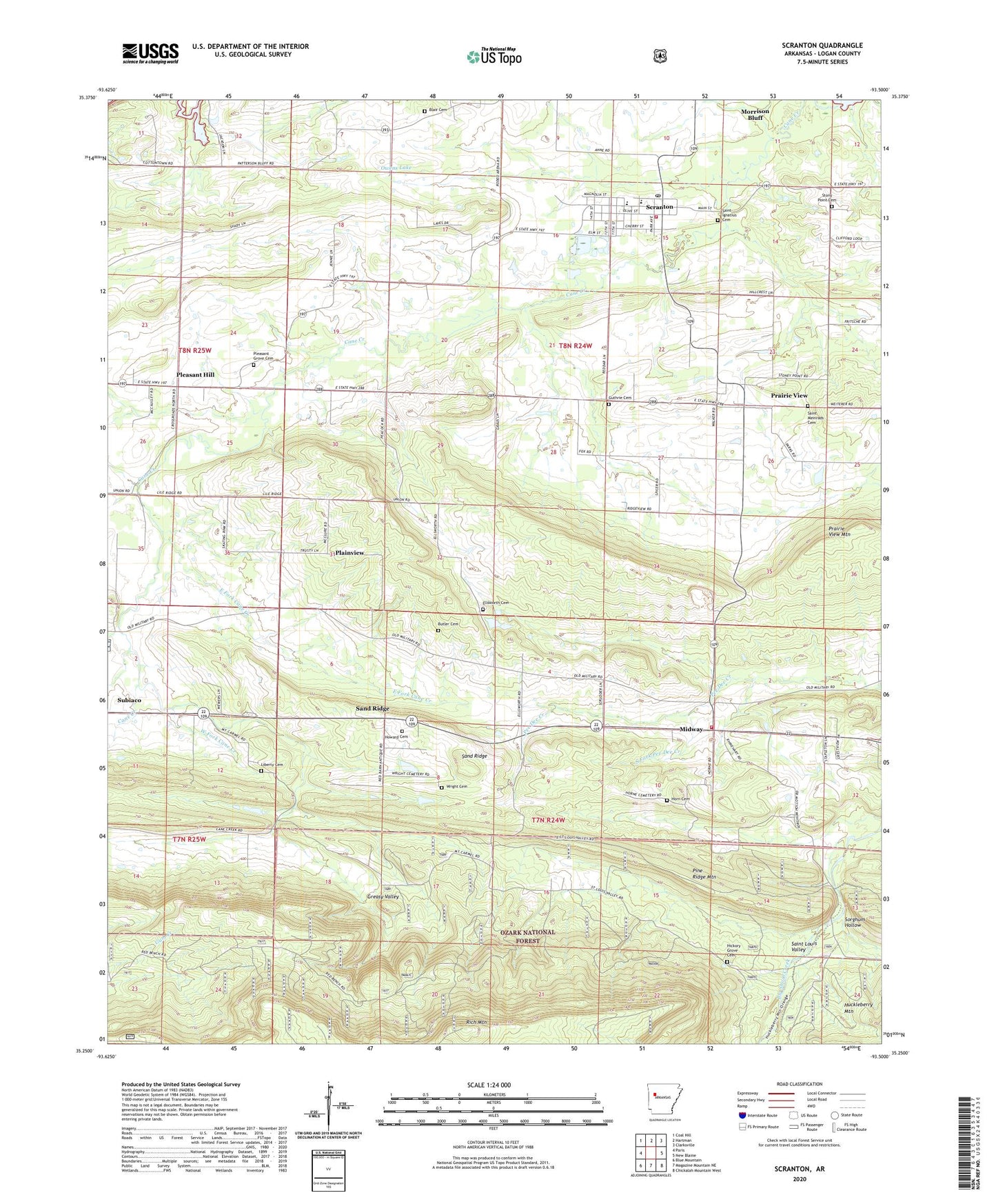
Scranton Arkansas US Topo Map
Couldn't load pickup availability
Also explore the Scranton Forest Service Topo of this same quad for updated USFS data
2024 topographic map quadrangle Scranton in the state of Arkansas. Scale: 1:24000. Based on the newly updated USGS 7.5' US Topo map series, this map is in the following counties: Logan. The map contains contour data, water features, and other items you are used to seeing on USGS maps, but also has updated roads and other features. This is the next generation of topographic maps. Printed on high-quality waterproof paper with UV fade-resistant inks.
Quads adjacent to this one:
West: Paris
Northwest: Coal Hill
North: Hartman
Northeast: Clarksville
East: New Blaine
Southeast: Chickalah Mountain West
South: Magazine Mountain NE
Southwest: Blue Mountain
This map covers the same area as the classic USGS quad with code o35093c5.
Contains the following named places: Blair Cemetery, Butler Cemetery, City of Scranton, Crestview Baptist Church, East Fork Cane Creek, Ellsworth, Ellsworth Cemetery, Friendship Primitive Baptist Church, Guthrie Cemetery, Hickory Grove Cemetery, Horn Cemetery, Howard Cemetery, Liberty Cemetery, Midway, Midway Assembly of God, Midway Rural Fire Department, Missionary Baptist Church, Owens Lake, Owens Lake Dam, Plainview, Pleasant Grove Cemetery, Pleasant Hill, Prairie View, Prairie View Gas Field, Prairie View Mountain, Prairie View United Methodist Church, Rich Mountain, Saint Ignatius Cemetery, Saint Louis Valley, Saint Meinrads Cemetery, Sand Ridge, Scranton, Scranton Elementary School, Scranton Fire Department Station 1, Scranton High School, Scranton Post Office, Sorghum Hollow, South Fork Pee Dee Creek, Stony Point Cemetery, Township of Ellsworth, Township of Logan, West Fork Cane Creek, Wilkins, Wright Cemetery, ZIP Codes: 72863, 72865