MyTopo
Manson Arkansas US Topo Map
Couldn't load pickup availability
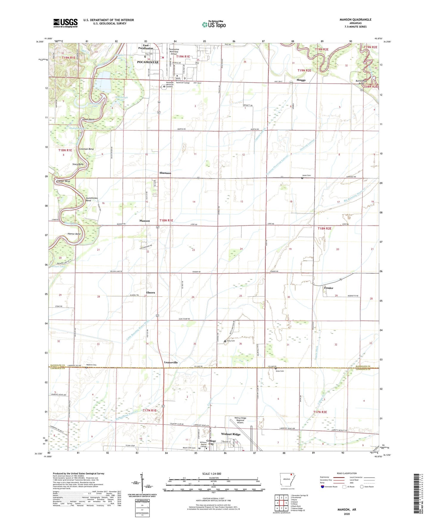
2024 topographic map quadrangle Manson in the state of Arkansas. Scale: 1:24000. Based on the newly updated USGS 7.5' US Topo map series, this map is in the following counties: Randolph, Lawrence. The map contains contour data, water features, and other items you are used to seeing on USGS maps, but also has updated roads and other features. This is the next generation of topographic maps. Printed on high-quality waterproof paper with UV fade-resistant inks.
Quads adjacent to this one:
West: Noland
Northwest: Ravenden Springs SE
North: Pocahontas
Northeast: Reyno
Southeast: Walnut Ridge SE
South: Walnut Ridge
Southwest: Black Rock
This map covers the same area as the classic USGS quad with code o36090b8.
Contains the following named places: Black River Technical College Law Enforcement Training Academy, Black River Vocational Technical School, Bristoe School, Buttermilk Bend, Chesser Bend, City of College City, College City, Cypress Lateral, Cypress Overcup Lateral, Dishpan Lake, Duty Cemetery, East Gate Plaza Shopping Center, Elnora, Fender, Gum Stump Church, Gum Stump School, Gumthicket Bend, Hoover Bend, Hoover Landing, Horseshoe Lake, Inman Bend, Jones Cemetery, Lesterville, Lesterville School, Little Running Water Ditch, Lone Oak Church, Luteman Bend, Manson, Manson School, Mill Creek, Mitt School, Moran School, Mount Zion Cemetery, Mount Zion Church, Overcup Lateral, Pocahontas Fire Department Station 2, Pocahontas Municipal Airport, Randolph Memorial Gardens, Shakybog Lake, Shannon, Shannon Baptist Church, Skaggs, Skaggs Baptist Church, Skaggs Church of Christ, Skaggs Ferry, Skaggs School, Snow Cemetery, Stacy Bend, Straight Branch, Surridge School, Township of Bristow, Township of Wiley, Troy Cemetery, Tupelo Ditch, Walnut Ridge Air Force Station, Walnut Ridge Army Air Field, Walnut Ridge Regional Airport, Watkins Cemetery, Williams Baptist College, Winebaugh Lake